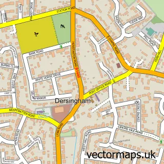
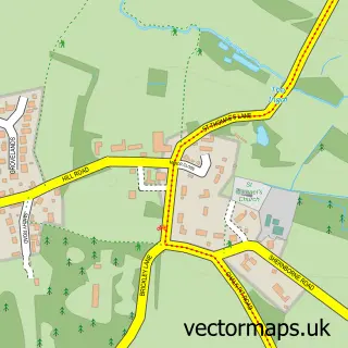
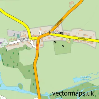
This Doddshill street map is a detailed vector street map covering a 750m x 750m area. Select a larger area to create and download your own vector street map of Doddshill.
The 750-metre map sample for Doddshill covers 68 mapped buildings and approximately 7.6 km of road detail, of which 5 named roads are named. The immediate area includes 1 school and 2 MOT stations within 2 miles. The wider area around Doddshill features 2 campsites within 2 miles. To create a larger or custom map of Doddshill, the map builder lets you define your own coverage area and download editable SVG, PDF and PNG files.
Create a larger editable map of Doddshill
Choose any area you need and generate a high-quality vector map instantly. Perfect for print, planning, design, business and personal use.

This Doddshill street map in Norfolk is available as downloadable SVG, PDF and PNG map files, or as a printed map for planning, business, display, education, local information and design work. You can also create a larger custom map area using the map selector.
What this Doddshill map sample shows
Doddshill lies within Dersingham Cp parish, part of Dersingham ward in the King's Lynn And West Norfolk District (B) local authority area. The postcode geography for this area includes the PE postcode area, the PE31 postcode district and the PE31 6 postcode sector. Residents fall under the Nhs Norfolk And Waveney Integrated Care Board for NHS services.
Local features near Doddshill
Within 2 milesAmenities and services in and around Doddshill.
Administrative and postcode information for Doddshill
The local authority covering Doddshill is King's Lynn And West Norfolk District (B), within the county of Norfolk. The settlement lies within Dersingham ward and Dersingham Cp civil parish. The PE31 postcode district and PE31 6 postcode sector serve the immediate area. NHS provision in the area is delivered through The Queen Elizabeth Hospital, King's Lynn, Nhs Foundation Trust.
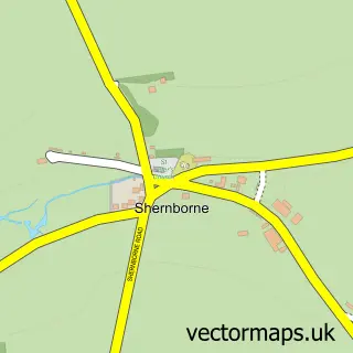
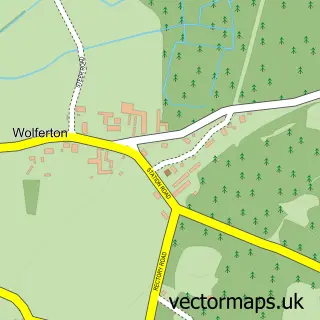
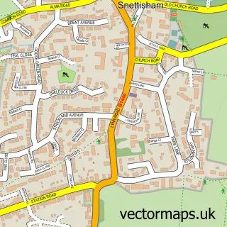
Nearby street map samples around Doddshill

More street maps in Norfolk
750 metre map area coverage
Boundary, postcode and point of interest information for the 750m x 750m rectangle centred on this sample map.
Boundaries containing map centre
Constituency: North West Norfolk Co Const
County: Norfolk County
District: King's Lynn and West Norfolk District (B)
Icb: NHS Norfolk and Waveney ICB
Parish: Dersingham CP
Police Force: norfolk
Postcode District: PE31
Postcode Sector: PE31 6
Ward: Dersingham Ward
Nearby boundaries intersecting sample
Parish: Sandringham CP
Postcode coverage
POI category counts
Elementary School: 3
Accountant: 1
Building Supply Store: 1
Church Cathedral: 1
Dialysis Clinic: 1
Family Practice: 1
Financial Advising: 1
Hair Salon: 1
Medical Service Organizations: 1
Printing Services: 1
Sample points of interest
- Ewing Accounts Services Ltd.
- Foxglove Electrical
- Dersingham Church
- Norfolk Dialysis
- Dersingham VA Primary School
- St Georges Junior School
- St Georges Secondary School Dersingham
- Carole Brown Health Centre
- Allen Tomas & Co Financial Management Ltd
- The Barn Hair & Beauty
- St Nicholas Endoscopy Unit
- Dolphin Graphics
Create a larger editable map of Doddshill
This sample shows only a 750 metre area. To create a larger map of Doddshill, use our map builder to choose your own coverage area, add titles and download editable SVG, PDF and PNG files.
Create a custom map of Doddshill