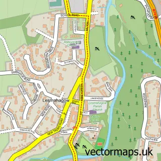
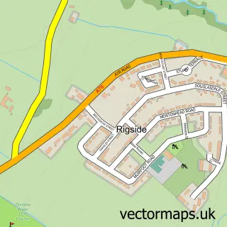
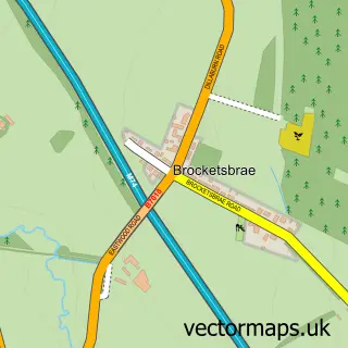
This Douglas street map is a detailed vector street map covering a 750m x 750m area. Select a larger area to create and download your own vector street map of Douglas.
The 750-metre map sample for Douglas covers 233 mapped buildings and approximately 12.5 km of road detail, of which 29 named roads are named. The immediate area includes 1 GP surgery and 1 pub. The wider area around Douglas features 2 tourism points of interest, 3 food and drink venues and 1 hotel. To create a larger or custom map of Douglas, the map builder lets you define your own coverage area and download editable SVG, PDF and PNG files.
Create a larger editable map of Douglas
Choose any area you need and generate a high-quality vector map instantly. Perfect for print, planning, design, business and personal use.

This Douglas street map in Lanarkshire is available as downloadable SVG, PDF and PNG map files, or as a printed map for planning, business, display, education, local information and design work. You can also create a larger custom map area using the map selector.
What this Douglas map sample shows
Douglas lies within South Lanarkshire parish, part of Clydesdale South ward in the South Lanarkshire local authority area. The postcode geography for this area includes the ML postcode area, the ML11 postcode district and the ML11 0 postcode sector. Residents fall under the Lanarkshire for NHS services.
Local features near Douglas
Within 2 milesAmenities and services in and around Douglas.
Administrative and postcode information for Douglas
The local authority covering Douglas is South Lanarkshire, within the county of Lanarkshire. The settlement lies within Clydesdale South ward and South Lanarkshire civil parish. The ML11 postcode district and ML11 0 postcode sector serve the immediate area. NHS provision in the area is delivered through Lanarkshire.
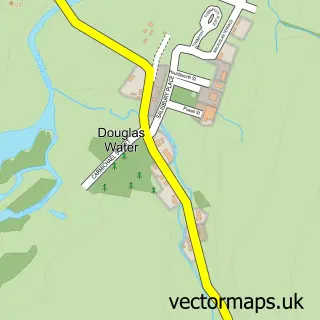
Nearby street map samples around Douglas

More street maps in Lanarkshire
750 metre map area coverage
Boundary, postcode and point of interest information for the 750m x 750m rectangle centred on this sample map.
Boundaries containing map centre
Constituency: Dumfriesshire, Clydesdale and Tweeddale Co Const
District: South Lanarkshire
Icb: Lanarkshire
Postcode District: ML11
Postcode Sector: ML11 0
Ward: Clydesdale South Ward
Nearby boundaries intersecting sample
No additional intersecting boundaries found.
Postcode coverage
POI category counts
Convenience Store: 4
Bar: 2
Beauty Salon: 2
Church Cathedral: 2
Community Center: 2
Elementary School: 2
Rental Kiosks: 2
Advertising Agency: 1
Art Gallery: 1
Attractions And Activities: 1
Sample points of interest
- CGIFurniture
- Carol Taylor Artists Studio & Gallery
- Polish Memorial Garden
- Douglas Bakery
- RBS
- Royal Bank of Scotland
- Country Club Inn
- The Keys
- Emma's Beauty
- True Reflection Wedding Make Up
- The Cycle Worx
- Douglas Victoria Bowling Club
Create a larger editable map of Douglas
This sample shows only a 750 metre area. To create a larger map of Douglas, use our map builder to choose your own coverage area, add titles and download editable SVG, PDF and PNG files.
Create a custom map of Douglas