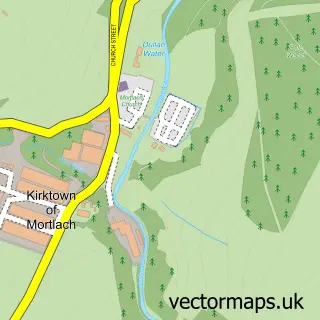
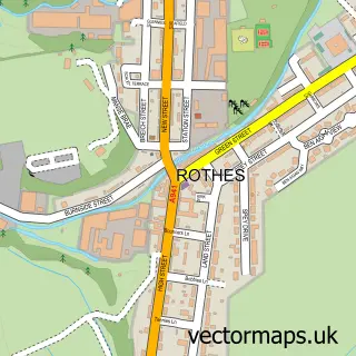
This Dufftown street map is a detailed vector street map covering a 750m x 750m area. Select a larger area to create and download your own vector street map of Dufftown.
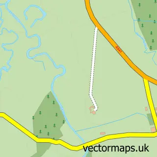
The 750-metre map sample for Dufftown covers 458 mapped buildings and approximately 15.3 km of road detail, of which 26 named roads are named. The immediate area includes 1 GP surgery and 1 MOT station. The wider area around Dufftown features 2 tourism points of interest, 6 food and drink venues and 4 hotels. To create a larger or custom map of Dufftown, the map builder lets you define your own coverage area and download editable SVG, PDF and PNG files.
Create a larger editable map of Dufftown
Choose any area you need and generate a high-quality vector map instantly. Perfect for print, planning, design, business and personal use.

This Dufftown street map in Banffshire is available as downloadable SVG, PDF and PNG map files, or as a printed map for planning, business, display, education, local information and design work. You can also create a larger custom map area using the map selector.
What this Dufftown map sample shows
Dufftown lies within Moray parish, part of Speyside Glenlivet ward in the Moray local authority area. The postcode geography for this area includes the AB postcode area, the AB55 postcode district and the AB55 4 postcode sector. Residents fall under the Grampian for NHS services.
Local features near Dufftown
Within 2 milesAmenities and services in and around Dufftown.
Administrative and postcode information for Dufftown
Dufftown lies within Moray parish, part of Speyside Glenlivet ward in the Moray local authority area. The postcode geography for this area includes the AB postcode area, the AB55 postcode district and the AB55 4 postcode sector. Residents fall under the Grampian for NHS services.
Nearby street map samples around Dufftown

More street maps in Banffshire
750 metre map area coverage
Boundary, postcode and point of interest information for the 750m x 750m rectangle centred on this sample map.
Boundaries containing map centre
Constituency: Moray West, Nairn and Strathspey Co Const
District: Moray
Icb: Grampian
Postcode District: AB55
Postcode Sector: AB55 4
Ward: Speyside Glenlivet Ward
Nearby boundaries intersecting sample
No additional intersecting boundaries found.
Postcode coverage
POI category counts
Bed And Breakfast: 9
Hotel: 4
Restaurant: 4
Beauty Salon: 3
Bar: 2
Cafe: 2
Community Center: 2
Convenience Store: 2
Distillery: 2
Grocery Store: 2
Sample points of interest
- Fournet House Lifestyle
- Dufftown Glassworks
- The Cooperative Food Dufftown, Dufftown
- J & I Smith
- RBS
- The Royal Bank of Scotland
- St James Lodge
- The Stillman Bar and Restaurant Dufftown
- Shannon Jade Beauty
- Faye's FABeauty | Keith
- The Doll House Dufftown
- The Salon
Create a larger editable map of Dufftown
This sample shows only a 750 metre area. To create a larger map of Dufftown, use our map builder to choose your own coverage area, add titles and download editable SVG, PDF and PNG files.
Create a custom map of Dufftown