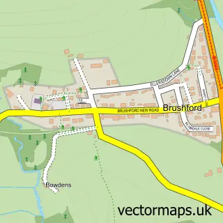
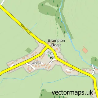
This Dulverton street map is a detailed vector street map covering a 750m x 750m area. Select a larger area to create and download your own vector street map of Dulverton.
The 750-metre map sample for Dulverton covers 191 mapped buildings and approximately 14.0 km of road detail, of which 23 named roads are named. The immediate area includes 2 schools, 1 GP surgery, 3 pubs and 1 MOT station, with 2 within 2 miles. The wider area around Dulverton features 4 tourism points of interest, 6 food and drink venues and 5 hotels. To create a larger or custom map of Dulverton, the map builder lets you define your own coverage area and download editable SVG, PDF and PNG files.
Create a larger editable map of Dulverton
Choose any area you need and generate a high-quality vector map instantly. Perfect for print, planning, design, business and personal use.

This Dulverton street map in Somerset is available as downloadable SVG, PDF and PNG map files, or as a printed map for planning, business, display, education, local information and design work. You can also create a larger custom map area using the map selector.
What this Dulverton map sample shows
Dulverton lies within Dulverton Cp parish, part of Dulverton & District ward in the Somerset local authority area. The postcode geography for this area includes the TA postcode area, the TA22 postcode district and the TA22 9 postcode sector. Residents fall under the Nhs Somerset Integrated Care Board for NHS services.
Local features near Dulverton
Within 2 milesAmenities and services in and around Dulverton.
Administrative and postcode information for Dulverton
The local authority covering Dulverton is Somerset, within the county of Somerset. The settlement lies within Dulverton & District ward and Dulverton Cp civil parish. The TA22 postcode district and TA22 9 postcode sector serve the immediate area. NHS provision in the area is delivered through Somerset Nhs Foundation Trust.
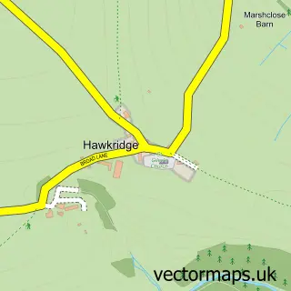
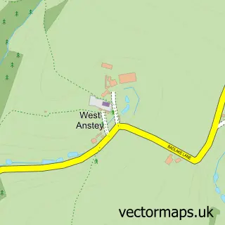
Nearby street map samples around Dulverton


More street maps in Somerset
750 metre map area coverage
Boundary, postcode and point of interest information for the 750m x 750m rectangle centred on this sample map.
Boundaries containing map centre
Constituency: Tiverton and Minehead Co Const
District: Somerset
Icb: NHS Somerset ICB
Parish: Dulverton CP
Police Force: avon and somerset
Postcode District: TA22
Postcode Sector: TA22 9
Nearby boundaries intersecting sample
No additional intersecting boundaries found.
Postcode coverage
POI category counts
Hotel: 4
Butcher Shop: 3
Charity Organization: 3
Church Cathedral: 3
Flowers And Gifts Shop: 3
Hair Salon: 3
Pub: 3
Real Estate Agent: 3
Shopping: 3
Veterinarian: 3
Sample points of interest
- Dulverton Angling Association
- Dulverton Cricket Club
- All Saints' Church, Dulverton
- Acorn Antiques
- Hardy Antiques
- The Old Blacksmiths Gallery
- Rock House Inn
- The Cooperative Food (BF) Dulverton, Fore Street
- Instavolt Charging Station
- NatWest Mobile Branch
- Isis Wellbeing and Skin Care
- Royal Salon
Create a larger editable map of Dulverton
This sample shows only a 750 metre area. To create a larger map of Dulverton, use our map builder to choose your own coverage area, add titles and download editable SVG, PDF and PNG files.
Create a custom map of Dulverton