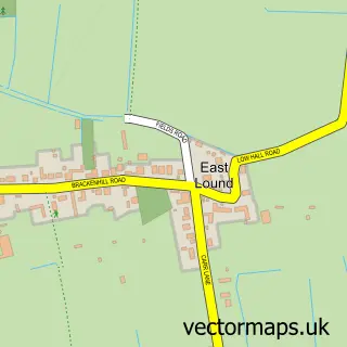
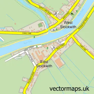
This East Ferry street map is a detailed vector street map covering a 750m x 750m area. Select a larger area to create and download your own vector street map of East Ferry.
The 750-metre map sample for East Ferry covers 182 mapped buildings and approximately 29.5 km of road detail, of which 6 named roads are named. The immediate area includes 3 pubs. The wider area around East Ferry features 1 tourism point of interest and 3 food and drink venues. To create a larger or custom map of East Ferry, the map builder lets you define your own coverage area and download editable SVG, PDF and PNG files.
Create a larger editable map of East Ferry
Choose any area you need and generate a high-quality vector map instantly. Perfect for print, planning, design, business and personal use.

This East Ferry street map in Lincolnshire is available as downloadable SVG, PDF and PNG map files, or as a printed map for planning, business, display, education, local information and design work. You can also create a larger custom map area using the map selector.
What this East Ferry map sample shows
East Ferry lies within East Ferry Cp parish, part of Scotter And Blyton ward in the West Lindsey District local authority area. The postcode geography for this area includes the DN postcode area, the DN21 postcode district and the DN21 3 postcode sector. Residents fall under the Nhs Lincolnshire Integrated Care Board for NHS services.
Local features near East Ferry
Within 2 milesAmenities and services in and around East Ferry.
Administrative and postcode information for East Ferry
East Ferry lies within East Ferry Cp parish, part of Scotter And Blyton ward in the West Lindsey District local authority area. The postcode geography for this area includes the DN postcode area, the DN21 postcode district and the DN21 3 postcode sector. Residents fall under the Nhs Lincolnshire Integrated Care Board for NHS services.
Nearby street map samples around East Ferry

More street maps in Lincolnshire
750 metre map area coverage
Boundary, postcode and point of interest information for the 750m x 750m rectangle centred on this sample map.
Boundaries containing map centre
Constituency: Gainsborough Co Const
County: Lincolnshire County
District: West Lindsey District
Icb: NHS Lincolnshire ICB
Parish: East Ferry CP
Police Force: lincolnshire
Postcode District: DN21
Postcode Sector: DN21 3
Ward: Scotter and Blyton Ward
Nearby boundaries intersecting sample
Constituency: Doncaster East and the Isle of Axholme Co Const
District: North Lincolnshire (B)
Icb: NHS Humber and North Yorkshire ICB
Parish: Owston Ferry CP
Police Force: humberside
Postcode District: DN9
Postcode Sector: DN9 1
Ward: Axholme South Ward
Postcode coverage
POI category counts
Pub: 3
Post Office: 2
Battery Store: 1
Medical Center: 1
Museum: 1
Plumbing: 1
Retirement Home: 1
Security Services: 1
Shipping Center: 1
Sample points of interest
- B.O.M Batteries
- Lindum Court Residential Home
- Owston Ferry Pumping Engine Preservation Society
- M J Harvey
- Owston Ferry Post Office
- Post Office
- The Crooked Billet Inn and Kitchen
- The Crooked Billet pub/restaurant
- White Hart Owston Ferry
- Plenus Care Ltd
- Switch Mortgages Doncaster
- Post Office-Owston Ferry
Create a larger editable map of East Ferry
This sample shows only a 750 metre area. To create a larger map of East Ferry, use our map builder to choose your own coverage area, add titles and download editable SVG, PDF and PNG files.
Create a custom map of East Ferry