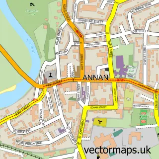
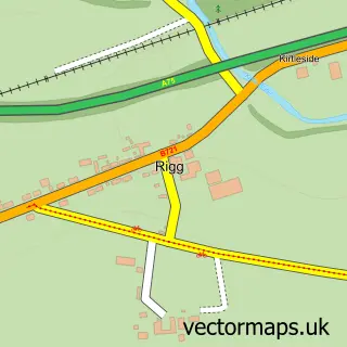
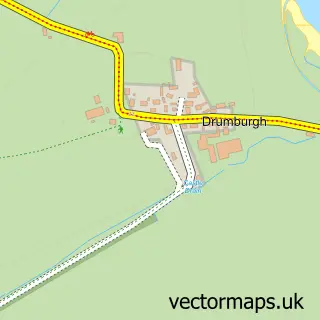
This Eastriggs street map is a detailed vector street map covering a 750m x 750m area. Select a larger area to create and download your own vector street map of Eastriggs.
The 750-metre map sample for Eastriggs covers 323 mapped buildings and approximately 14.2 km of road detail, of which 29 named roads are named. The immediate area includes 1 MOT station, with 3 within 2 miles. To create a larger or custom map of Eastriggs, the map builder lets you define your own coverage area and download editable SVG, PDF and PNG files.
Create a larger editable map of Eastriggs
Choose any area you need and generate a high-quality vector map instantly. Perfect for print, planning, design, business and personal use.

This Eastriggs street map in Dumfries is available as downloadable SVG, PDF and PNG map files, or as a printed map for planning, business, display, education, local information and design work. You can also create a larger custom map area using the map selector.
What this Eastriggs map sample shows
Eastriggs lies within Dumfries And Galloway parish, part of Annandale South ward in the Dumfries And Galloway local authority area. The postcode geography for this area includes the DG postcode area, the DG12 postcode district and the DG12 6 postcode sector. Residents fall under the Dumfries And Galloway for NHS services.
Local features near Eastriggs
Within 2 milesAmenities and services in and around Eastriggs.
Administrative and postcode information for Eastriggs
Eastriggs lies within Dumfries And Galloway parish, part of Annandale South ward in the Dumfries And Galloway local authority area. The postcode geography for this area includes the DG postcode area, the DG12 postcode district and the DG12 6 postcode sector. Residents fall under the Dumfries And Galloway for NHS services.
Nearby street map samples around Eastriggs

More street maps in Dumfries
750 metre map area coverage
Boundary, postcode and point of interest information for the 750m x 750m rectangle centred on this sample map.
Boundaries containing map centre
Constituency: Dumfriesshire, Clydesdale and Tweeddale Co Const
District: Dumfries and Galloway
Icb: Dumfries and Galloway
Postcode District: DG12
Postcode Sector: DG12 6
Ward: Annandale South Ward
Nearby boundaries intersecting sample
No additional intersecting boundaries found.
Postcode coverage
POI category counts
Bar: 2
Fish And Chips Restaurant: 2
Pharmacy: 2
Barber: 1
Business: 1
Business Manufacturing And Supply: 1
Carpet Store: 1
Charity Organization: 1
Chocolatier: 1
Church Cathedral: 1
Sample points of interest
- New Imperial
- Wayside Inn
- SJ Barbers
- Stem Drive Ltd
- Allwood Products
- First Edition Carpets
- Eastriggs & Gretna Heritage Group
- Co Co Company
- St John the Evangelist
- SPAR Eastriggs
- Post Office-Eastriggs
- Eastriggs Community School
Create a larger editable map of Eastriggs
This sample shows only a 750 metre area. To create a larger map of Eastriggs, use our map builder to choose your own coverage area, add titles and download editable SVG, PDF and PNG files.
Create a custom map of Eastriggs