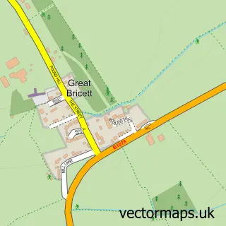
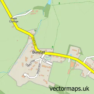
This Elmsett street map is a detailed vector street map covering a 750m x 750m area. Select a larger area to create and download your own vector street map of Elmsett.
The 750-metre map sample for Elmsett covers 238 mapped buildings and approximately 11.4 km of road detail, of which 13 named roads are named. The immediate area includes 2 schools and 2 pubs. The wider area around Elmsett features 2 food and drink venues. To create a larger or custom map of Elmsett, the map builder lets you define your own coverage area and download editable SVG, PDF and PNG files.
Create a larger editable map of Elmsett
Choose any area you need and generate a high-quality vector map instantly. Perfect for print, planning, design, business and personal use.

This Elmsett street map in Suffolk is available as downloadable SVG, PDF and PNG map files, or as a printed map for planning, business, display, education, local information and design work. You can also create a larger custom map area using the map selector.
What this Elmsett map sample shows
Elmsett lies within Elmsett Cp parish, part of South East Cosford ward in the Babergh District local authority area. The postcode geography for this area includes the IP postcode area, the IP7 postcode district and the IP7 6 postcode sector. Residents fall under the Nhs Suffolk And North East Essex Integrated Care Board for NHS services.
Local features near Elmsett
Within 2 milesAmenities and services in and around Elmsett.
Administrative and postcode information for Elmsett
Elmsett lies within Elmsett Cp parish, part of South East Cosford ward in the Babergh District local authority area. The postcode geography for this area includes the IP postcode area, the IP7 postcode district and the IP7 6 postcode sector. Residents fall under the Nhs Suffolk And North East Essex Integrated Care Board for NHS services.
Nearby street map samples around Elmsett

More street maps in Suffolk
750 metre map area coverage
Boundary, postcode and point of interest information for the 750m x 750m rectangle centred on this sample map.
Boundaries containing map centre
Constituency: South Suffolk Co Const
County: Suffolk County
District: Babergh District
Icb: NHS Essex ICB
Parish: Elmsett CP
Police Force: suffolk
Postcode District: IP7
Postcode Sector: IP7 6
Ward: South East Cosford Ward
Nearby boundaries intersecting sample
No additional intersecting boundaries found.
Postcode coverage
POI category counts
Elementary School: 2
Post Office: 2
Pub: 2
Building Supply Store: 1
Car Dealer: 1
E Commerce Service: 1
Natural Gas Supplier: 1
Package Locker: 1
Religious Organization: 1
Roofing: 1
Sample points of interest
- Curson Carpentry
- KMA Forklifts
- Buckingham Rod Repairs
- Elmsett C of E Voluntary Controlled Primary School
- Elmsett Church of England V.C. Primary School
- Post Office-Elmsett
- InPost
- Elmsett Post Office
- Elmsett Village Stores
- Rose & Crown Pub, Elmsett
- The Rose and Crown Elmsett
- Elmsett Methodist Church
Create a larger editable map of Elmsett
This sample shows only a 750 metre area. To create a larger map of Elmsett, use our map builder to choose your own coverage area, add titles and download editable SVG, PDF and PNG files.
Create a custom map of Elmsett