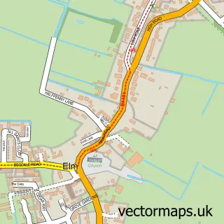
This Emneth street map is a detailed vector street map covering a 750m x 750m area. Select a larger area to create and download your own vector street map of Emneth.
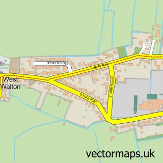
The 750-metre map sample for Emneth covers 404 mapped buildings and approximately 16.5 km of road detail, of which 18 named roads are named. The immediate area includes 1 school, 1 pub and 4 MOT stations within 2 miles. The wider area around Emneth features 1 tourism point of interest and 2 food and drink venues. To create a larger or custom map of Emneth, the map builder lets you define your own coverage area and download editable SVG, PDF and PNG files.
Create a larger editable map of Emneth
Choose any area you need and generate a high-quality vector map instantly. Perfect for print, planning, design, business and personal use.

This Emneth street map in Norfolk is available as downloadable SVG, PDF and PNG map files, or as a printed map for planning, business, display, education, local information and design work. You can also create a larger custom map area using the map selector.
What this Emneth map sample shows
Emneth lies within Emneth Cp parish, part of Emneth & Outwell ward in the King's Lynn And West Norfolk District (B) local authority area. The postcode geography for this area includes the PE postcode area, the PE14 postcode district and the PE14 8 postcode sector. Residents fall under the Nhs Norfolk And Waveney Integrated Care Board for NHS services.
Local features near Emneth
Within 2 milesAmenities and services in and around Emneth.
Administrative and postcode information for Emneth
Emneth lies within Emneth Cp parish, part of Emneth & Outwell ward in the King's Lynn And West Norfolk District (B) local authority area. The postcode geography for this area includes the PE postcode area, the PE14 postcode district and the PE14 8 postcode sector. Residents fall under the Nhs Norfolk And Waveney Integrated Care Board for NHS services.
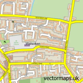
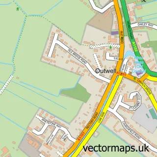
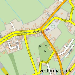
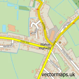
Nearby street map samples around Emneth

More street maps in Norfolk
750 metre map area coverage
Boundary, postcode and point of interest information for the 750m x 750m rectangle centred on this sample map.
Boundaries containing map centre
Constituency: South West Norfolk Co Const
County: Norfolk County
District: King's Lynn and West Norfolk District (B)
Icb: NHS Norfolk and Waveney ICB
Parish: Emneth CP
Police Force: norfolk
Postcode District: PE14
Postcode Sector: PE14 8
Ward: Emneth & Outwell Ward
Nearby boundaries intersecting sample
No additional intersecting boundaries found.
Postcode coverage
POI category counts
Convenience Store: 3
Beauty Salon: 2
Painting: 2
Agricultural Service: 1
Atms: 1
Automotive Repair: 1
Cafe: 1
Chinese Restaurant: 1
Clothing Store: 1
Driving School: 1
Sample points of interest
- Cousins Of Emneth Ltd
- PayPoint
- Fenland Offroad
- Gemini Beauty
- The Nail Room
- Sweet Things Savoury
- Jade Garden fish bar &Chinese takeaway
- Avormen Apparel
- Emneth Premier
- Premier
- Premier Emneth Convenience Store
- Front Seat Driving School
Create a larger editable map of Emneth
This sample shows only a 750 metre area. To create a larger map of Emneth, use our map builder to choose your own coverage area, add titles and download editable SVG, PDF and PNG files.
Create a custom map of Emneth