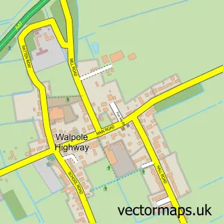
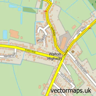
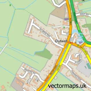
This Marshland St James street map is a detailed vector street map covering a 750m x 750m area. Select a larger area to create and download your own vector street map of Marshland St James.
The 750-metre map sample for Marshland St James covers 233 mapped buildings and approximately 4.3 km of road detail, of which 3 named roads are named. The immediate area includes 1 school and 1 MOT station within 2 miles. The wider area around Marshland St James features 1 tourism point of interest and 1 campsite within 2 miles. To create a larger or custom map of Marshland St James, the map builder lets you define your own coverage area and download editable SVG, PDF and PNG files.
Create a larger editable map of Marshland St James
Choose any area you need and generate a high-quality vector map instantly. Perfect for print, planning, design, business and personal use.

This Marshland St James street map in Norfolk is available as downloadable SVG, PDF and PNG map files, or as a printed map for planning, business, display, education, local information and design work. You can also create a larger custom map area using the map selector.
What this Marshland St James map sample shows
Marshland St James lies within Marshland St. James Cp parish, part of Tilney, Mershe Lande & Wiggenhall ward in the King's Lynn And West Norfolk District (B) local authority area. The postcode geography for this area includes the PE postcode area, the PE14 postcode district and the PE14 8 postcode sector. Residents fall under the Nhs Norfolk And Waveney Integrated Care Board for NHS services.
Local features near Marshland St James
Within 2 milesAmenities and services in and around Marshland St James.
Administrative and postcode information for Marshland St James
Marshland St James lies within Marshland St. James Cp parish, part of Tilney, Mershe Lande & Wiggenhall ward in the King's Lynn And West Norfolk District (B) local authority area. The postcode geography for this area includes the PE postcode area, the PE14 postcode district and the PE14 8 postcode sector. Residents fall under the Nhs Norfolk And Waveney Integrated Care Board for NHS services.
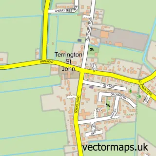
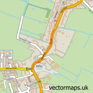
Nearby street map samples around Marshland St James

More street maps in Norfolk
750 metre map area coverage
Boundary, postcode and point of interest information for the 750m x 750m rectangle centred on this sample map.
Boundaries containing map centre
Constituency: South West Norfolk Co Const
County: Norfolk County
District: King's Lynn and West Norfolk District (B)
Icb: NHS Norfolk and Waveney ICB
Parish: Marshland St. James CP
Police Force: norfolk
Postcode District: PE14
Postcode Sector: PE14 8
Ward: Tilney, Mershe Lande & Wiggenhall Ward
Nearby boundaries intersecting sample
No additional intersecting boundaries found.
Postcode coverage
POI category counts
Bakery: 1
Carpenter: 1
Elementary School: 1
Event Technology Service: 1
Fruits And Vegetables: 1
Gift Shop: 1
Landmark And Historical Building: 1
Nursery And Gardening: 1
Telecommunications: 1
Train Station: 1
Sample points of interest
- Debelicious Cakes
- Philip Wagg Carpenter and Builder UPVC Double Glazing
- Marshland St James VC Primary School and Nursery
- Bouncy Party Hire
- Fenberry Farm Ltd (Owners M & M Thorpe)
- Mancave Online
- Cambridgeshire
- Marshland Herb Nursery
- Katie Denham Marketing
- Smeeth Road railway station
- Eurobulbs
Create a larger editable map of Marshland St James
This sample shows only a 750 metre area. To create a larger map of Marshland St James, use our map builder to choose your own coverage area, add titles and download editable SVG, PDF and PNG files.
Create a custom map of Marshland St James