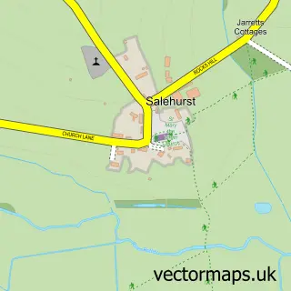
This Etchingham street map is a detailed vector street map covering a 750m x 750m area. Select a larger area to create and download your own vector street map of Etchingham.
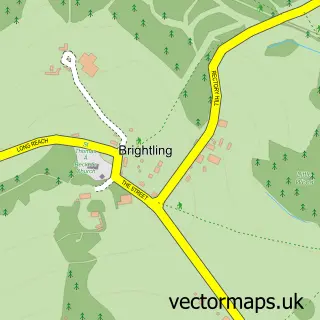
The 750-metre map sample for Etchingham covers 120 mapped buildings and approximately 6.3 km of road detail, of which 10 named roads are named. The immediate area includes 1 railway station and 1 MOT station within 2 miles. The wider area around Etchingham features 1 food and drink venue and 1 hotel. To create a larger or custom map of Etchingham, the map builder lets you define your own coverage area and download editable SVG, PDF and PNG files.
Create a larger editable map of Etchingham
Choose any area you need and generate a high-quality vector map instantly. Perfect for print, planning, design, business and personal use.

This Etchingham street map in East Sussex is available as downloadable SVG, PDF and PNG map files, or as a printed map for planning, business, display, education, local information and design work. You can also create a larger custom map area using the map selector.
What this Etchingham map sample shows
Etchingham lies within Etchingham Cp parish, part of Burwash & The Weald ward in the Rother District local authority area. The postcode geography for this area includes the TN postcode area, the TN19 postcode district and the TN19 7 postcode sector. Residents fall under the Nhs Sussex Integrated Care Board for NHS services.
Local features near Etchingham
Within 2 milesAmenities and services in and around Etchingham.
Administrative and postcode information for Etchingham
The local authority covering Etchingham is Rother District, within the county of East Sussex. The settlement lies within Burwash & The Weald ward and Etchingham Cp civil parish. The TN19 postcode district and TN19 7 postcode sector serve the immediate area. NHS provision in the area is delivered through Maidstone And Tunbridge Wells Nhs Trust.
Nearby street map samples around Etchingham

More street maps in East Sussex
750 metre map area coverage
Boundary, postcode and point of interest information for the 750m x 750m rectangle centred on this sample map.
Boundaries containing map centre
Constituency: Bexhill and Battle Co Const
County: East Sussex County
District: Rother District
Icb: NHS Surrey and Sussex ICB
Parish: Etchingham CP
Police Force: sussex
Postcode District: TN19
Postcode Sector: TN19 7
Ward: Burwash & the Weald Ward
Nearby boundaries intersecting sample
No additional intersecting boundaries found.
Postcode coverage
POI category counts
Automotive Repair: 2
Anglican Church: 1
Auto Customization: 1
Beauty And Spa: 1
Bed And Breakfast: 1
Building Supply Store: 1
Business Consulting: 1
Butcher Shop: 1
Church Cathedral: 1
Contractor: 1
Sample points of interest
- The Assumption of Blessed Mary & St Nicholas
- SK Conversions
- DWA Fleet and Vehicle Services
- Sussex Aircooled
- Nudi Spray
- Rosebank B&B
- Excel Carpet Care
- Transformational Leadership Consulting
- F J Jarvis
- Church of the Assumption of Blessed Mary and St Nicolas
- Ascent Builders
- Etchingham Shop & Deli
Create a larger editable map of Etchingham
This sample shows only a 750 metre area. To create a larger map of Etchingham, use our map builder to choose your own coverage area, add titles and download editable SVG, PDF and PNG files.
Create a custom map of Etchingham