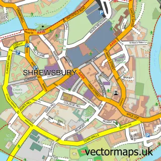
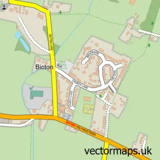
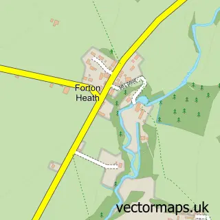
This Ford street map is a detailed vector street map covering a 750m x 750m area. Select a larger area to create and download your own vector street map of Ford.
The 750-metre map sample for Ford covers 188 mapped buildings and approximately 7.5 km of road detail, of which 10 named roads are named. The immediate area includes 1 school. The wider area around Ford features 1 hotel and 1 campsite within 2 miles. To create a larger or custom map of Ford, the map builder lets you define your own coverage area and download editable SVG, PDF and PNG files.
Create a larger editable map of Ford
Choose any area you need and generate a high-quality vector map instantly. Perfect for print, planning, design, business and personal use.

This Ford street map in Shropshire is available as downloadable SVG, PDF and PNG map files, or as a printed map for planning, business, display, education, local information and design work. You can also create a larger custom map area using the map selector.
What this Ford map sample shows
Ford lies within Ford Cp parish, part of Longden ward in the Shropshire local authority area. The postcode geography for this area includes the SY postcode area, the SY5 postcode district and the SY5 9 postcode sector. Residents fall under the Nhs Shropshire, Telford And Wrekin Integrated Care Board for NHS services.
Local features near Ford
Within 2 milesAmenities and services in and around Ford.
Administrative and postcode information for Ford
Ford lies within Ford Cp parish, part of Longden ward in the Shropshire local authority area. The postcode geography for this area includes the SY postcode area, the SY5 postcode district and the SY5 9 postcode sector. Residents fall under the Nhs Shropshire, Telford And Wrekin Integrated Care Board for NHS services.
Nearby street map samples around Ford

More street maps in Shropshire
750 metre map area coverage
Boundary, postcode and point of interest information for the 750m x 750m rectangle centred on this sample map.
Boundaries containing map centre
Constituency: Shrewsbury Co Const
District: Shropshire
Icb: NHS Shropshire Telford and Wrekin ICB
Parish: Ford CP
Police Force: west mercia
Postcode District: SY5
Postcode Sector: SY5 9
Nearby boundaries intersecting sample
No additional intersecting boundaries found.
Postcode coverage
POI category counts
Professional Services: 2
Anglican Church: 1
Auto Electrical Repair: 1
Beauty And Spa: 1
Beauty Product Supplier: 1
Beauty Salon: 1
Building Supply Store: 1
Business Consulting: 1
Carpenter: 1
Community Center: 1
Sample points of interest
- Ford: St Michael
- Collison Electrical Services
- Blossom Beauty Academy
- Be Beautiful Too
- Nichola Witcombe-Tant Beauty & Makeup
- DC Solutions for You
- Sales Essential Business Solutions
- Ben Reynolds Carpentry
- Ford Village Hall
- Portishead ground affects
- Collison Smart Systems - a company of CES
- Kate Satoor Childcare
Create a larger editable map of Ford
This sample shows only a 750 metre area. To create a larger map of Ford, use our map builder to choose your own coverage area, add titles and download editable SVG, PDF and PNG files.
Create a custom map of Ford