Vector Maps logo
Home Why it works Popular maps Districts Samples Customizer Create Your Map
VectorMaps.uk
Home Popular maps Districts Samples Customizer Create Your Map Privacy Disclaimer
Home / UK Maps / Ross and Cromarty / Gairloch Map

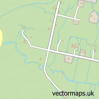
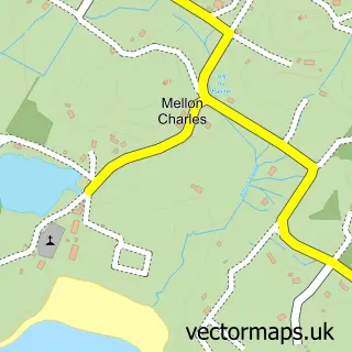
This Gairloch street map is a detailed vector street map covering a 750m x 750m area. Select a larger area to create and download your own vector street map of Gairloch.

Gairloch is a village in Ross And Cromarty, in the Highlands And Islands of Scotland. The settlement falls within the Ross, Skye And Lochaber parliamentary constituency. It is served by the IV21 postcode district, with IV21 2 as the local postcode sector.

The 750-metre map sample for Gairloch covers 51 mapped buildings and approximately 8.2 km of road detail, of which 5 named roads are named. The immediate area includes 1 MOT station within 2 miles. The wider area around Gairloch features 4 tourism points of interest, 2 food and drink venues and 3 hotels. To create a larger or custom map of Gairloch, the map builder lets you define your own coverage area and download editable SVG, PDF and PNG files.

51Buildings
8.19 kmRoads
5Named roads
0Residents within 2 miles
Create your own

Create a larger editable map of Gairloch

Choose any area you need and generate a high-quality vector map instantly. Perfect for print, planning, design, business and personal use.

Choose any location
Editable SVG files
Any size up to A0
PDF, PNG & more
Instant download
High quality guaranteed
Create My Custom Map
Secure, private & no credit card required
Gairloch Vector Street Map
750m Sample
Gairloch vector street map sample showing roads, buildings and local features in a 750 metre preview area
Buy Gairloch Map Print from £12.95 Buy Gairloch Digital Map from £6

This Gairloch street map in Ross and Cromarty is available as downloadable SVG, PDF and PNG map files, or as a printed map for planning, business, display, education, local information and design work. You can also create a larger custom map area using the map selector.

What this Gairloch map sample shows

Gairloch lies within Highland parish, part of Wester Ross, Strathpeffer And Lochalsh ward in the Highland local authority area. The postcode geography for this area includes the IV postcode area, the IV21 postcode district and the IV21 2 postcode sector. Residents fall under the Highland for NHS services.

Local features near Gairloch

Within 2 miles

Amenities and services in and around Gairloch.

1 Campsites within 2 miles
1 MOT stations within 2 miles
4 Tourism & leisure
2 Food & drink
3 Hotels
1 Healthcare POIs

Counts are approximate and based on publicly available data.

Administrative and postcode information for Gairloch

Gairloch lies within Highland parish, part of Wester Ross, Strathpeffer And Lochalsh ward in the Highland local authority area. The postcode geography for this area includes the IV postcode area, the IV21 postcode district and the IV21 2 postcode sector. Residents fall under the Highland for NHS services.

Parish HIGHLAND
Ward Wester Ross, Strathpeffer and Lochalsh
District / local authority Highland
County Ross and Cromarty
Historic county Ross and Cromarty
Postcode district IV21
Postcode sector IV21 2
Parliamentary constituency Ross, Skye and Lochaber
Region Highlands and Islands
Country Scotland

Nearby street map samples around Gairloch

Street map sample of Ullapool, Ross and Cromarty Ullapool Town - Ross and Cromarty - 22.7 miles Street map sample of Inverness, Inverness Inverness City - Inverness - 56.9 miles Street map sample of Badachro, Ross and Cromarty Badachro Village - Ross and Cromarty - 2.5 miles Street map sample of Port Henderson, Ross and Cromarty Port Henderson Village - Ross and Cromarty - 3.6 miles Street map sample of Poolewe, Ross and Cromarty Poolewe Village - Ross and Cromarty - 4.1 miles Street map sample of North Erradale, Ross and Cromarty North Erradale Village - Ross and Cromarty - 4.6 miles Street map sample of South Erradale, Ross and Cromarty South Erradale Village - Ross and Cromarty - 5.1 miles Street map sample of Inverasdale, Ross and Cromarty Inverasdale Village - Ross and Cromarty - 5.6 miles Street map sample of Aultbea, Ross and Cromarty Aultbea Village - Ross and Cromarty - 8.7 miles Street map sample of Mellon Charles, Ross and Cromarty Mellon Charles Village - Ross and Cromarty - 9.3 miles

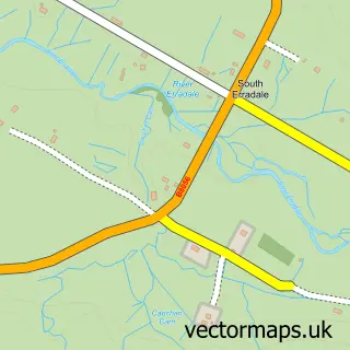
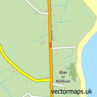
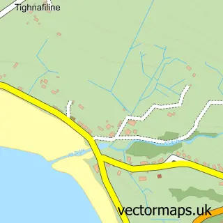
More street maps in Ross and Cromarty

Street map sample of Badachro, Ross and Cromarty Badachro Village - 2.5 miles Street map sample of Port Henderson, Ross and Cromarty Port Henderson Village - 3.6 miles Street map sample of Poolewe, Ross and Cromarty Poolewe Village - 4.1 miles Street map sample of North Erradale, Ross and Cromarty North Erradale Village - 4.6 miles Street map sample of South Erradale, Ross and Cromarty South Erradale Village - 5.1 miles

750 metre map area coverage

Boundary, postcode and point of interest information for the 750m x 750m rectangle centred on this sample map.

Boundaries containing map centre

Constituency: Inverness, Skye and West Ross-shire Co Const

District: Highland

Icb: Highland

Postcode District: IV21

Postcode Sector: IV21 2

Ward: Wester Ross, Strathpeffer and Lochalsh Ward

Nearby boundaries intersecting sample

No additional intersecting boundaries found.

Postcode coverage

IV21 IV21 2

POI category counts

Hotel: 3

Beach: 2

Bed And Breakfast: 2

Community Center: 2

Convenience Store: 2

Landmark And Historical Building: 2

Library: 2

Museum: 2

Travel Services: 2

Accountant: 1

Sample points of interest

  • PNL accounting Accountant
  • Painted Horse Antiques Antique Store
  • Gairloch Beach Beach
  • Slaggan Bay Beach
  • Aird Hill Bed & Breakfast Bed And Breakfast
  • Gairloch View Bed And Breakfast
  • Am Bard Cafe Cafe
  • Black Pearl Creole Kitchen Cajun And Creole Restaurant
  • Hai Yang Chinese Restaurant
  • Mountain Coffee Gairloch Coffee Shop
  • Gairloch Community Hall Community Center
  • Gale Centre Community Center

Create a larger editable map of Gairloch

This sample shows only a 750 metre area. To create a larger map of Gairloch, use our map builder to choose your own coverage area, add titles and download editable SVG, PDF and PNG files.

Create a custom map of Gairloch

Phone 01751 473136 | Copyright Vectormaps.uk 2026

Samples Customizer Privacy Disclaimer
Gairloch Vector Street Map
Gairloch enlarged street map sample showing a 750 metre preview area