Vector Maps logo
Home Why it works Popular maps Districts Samples Customizer Create Your Map
VectorMaps.uk
Home Popular maps Districts Samples Customizer Create Your Map Privacy Disclaimer
Home / UK Maps / Western Isles / Gearraidh na h-Aibhne Map

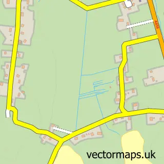
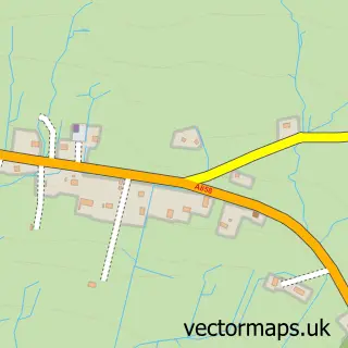
This Gearraidh na h-Aibhne street map is a detailed vector street map covering a 750m x 750m area. Select a larger area to create and download your own vector street map of Gearraidh na h-Aibhne.

Gearraidh na h-Aibhne is a village in Western Isles, in the Highlands And Islands of Scotland. Historically, the area formed part of Ross And Cromarty. The settlement falls within the Na H-Eileanan An Iar parliamentary constituency. It is served by the HS

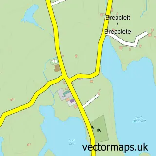
The 750-metre map sample for Gearraidh na h-Aibhne covers 41 mapped buildings and approximately 4.1 km of road detail. To create a larger or custom map of Gearraidh na h-Aibhne, the map builder lets you define your own coverage area and download editable SVG, PDF and PNG files.

41Buildings
4.11 kmRoads
0Named roads
0Residents within 2 miles
Create your own

Create a larger editable map of Gearraidh na h-Aibhne

Choose any area you need and generate a high-quality vector map instantly. Perfect for print, planning, design, business and personal use.

Choose any location
Editable SVG files
Any size up to A0
PDF, PNG & more
Instant download
High quality guaranteed
Create My Custom Map
Secure, private & no credit card required
Gearraidh na h-Aibhne Vector Street Map
750m Sample
Gearraidh na h-Aibhne vector street map sample showing roads, buildings and local features in a 750 metre preview area
Buy Gearraidh na h-Aibhne Map Print from £12.95 Buy Gearraidh na h-Aibhne Digital Map from £6

This Gearraidh na h-Aibhne street map in Western Isles is available as downloadable SVG, PDF and PNG map files, or as a printed map for planning, business, display, education, local information and design work. You can also create a larger custom map area using the map selector.

What this Gearraidh na h-Aibhne map sample shows

Gearraidh na h-Aibhne lies within Na H-Eileanan An Iar parish, part of Sgir'uige Agus Ceann A Tuath Nan Loch ward in the Na H-Eileanan An Iar local authority area. The postcode geography for this area includes the HS postcode area, the HS2 postcode district and the HS2 9 postcode sector. Residents fall under the Western Isles for NHS services.

Administrative and postcode information for Gearraidh na h-Aibhne

The local authority covering Gearraidh na h-Aibhne is Na H-Eileanan An Iar, within the county of Western Isles. The settlement lies within Sgir'uige Agus Ceann A Tuath Nan Loch ward and Na H-Eileanan An Iar civil parish. The HS2 postcode district and HS2 9 postcode sector serve the immediate area. NHS provision in the area is delivered through Western Isles.

Parish NA H-EILEANAN AN IAR
Ward Sgir'Uige agus Ceann a Tuath nan Loch
District / local authority Na h-Eileanan an Iar
County Western Isles
Historic county Ross and Cromarty
Postcode district HS2
Postcode sector HS2 9
Parliamentary constituency Na h-Eileanan an Iar
Region Highlands and Islands
Country Scotland

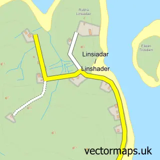
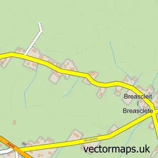
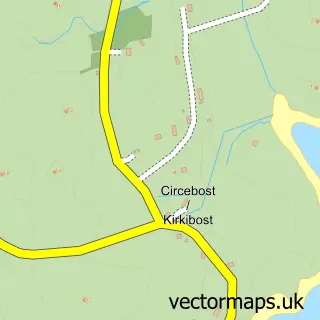
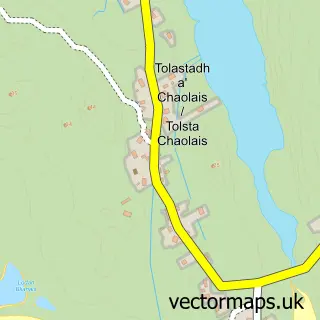
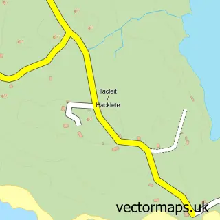
Nearby street map samples around Gearraidh na h-Aibhne

Street map sample of Steòrnabhagh, Western Isles Steòrnabhagh Town - Western Isles - 11.7 miles Street map sample of Inverness, Inverness Inverness City - Inverness - 103.6 miles Street map sample of Calanais, Western Isles Calanais Village - Western Isles - 1.4 miles Street map sample of Linsiadar, Western Isles Linsiadar Village - Western Isles - 1.6 miles Street map sample of Brèascleit, Western Isles Brèascleit Village - Western Isles - 2.6 miles Street map sample of Circebost, Western Isles Circebost Village - Western Isles - 3.4 miles Street map sample of Tolastadh a' Chaolais, Western Isles Tolastadh a' Chaolais Village - Western Isles - 4.5 miles Street map sample of An t-Achadh Mòr, Western Isles An t-Achadh Mòr Village - Western Isles - 5.0 miles Street map sample of Tacleit, Western Isles Tacleit Village - Western Isles - 5.4 miles Street map sample of Breacleit, Western Isles Breacleit Village - Western Isles - 5.5 miles

More street maps in Western Isles

Street map sample of Calanais, Western Isles Calanais Village - 1.4 miles Street map sample of Linsiadar, Western Isles Linsiadar Village - 1.6 miles Street map sample of Brèascleit, Western Isles Brèascleit Village - 2.6 miles Street map sample of Circebost, Western Isles Circebost Village - 3.4 miles Street map sample of Tolastadh a' Chaolais, Western Isles Tolastadh a' Chaolais Village - 4.5 miles

750 metre map area coverage

Boundary, postcode and point of interest information for the 750m x 750m rectangle centred on this sample map.

Boundaries containing map centre

Constituency: Na h-Eileanan an Iar Co Const

District: Na h-Eileanan an Iar

Icb: Western Isles

Postcode District: HS2

Postcode Sector: HS2 9

Ward: Sgir' Uige agus Carlabhagh Ward

Nearby boundaries intersecting sample

No additional intersecting boundaries found.

Postcode coverage

HS2 HS2 9

POI category counts

Construction Services: 1

Sample points of interest

  • Maclennan Contractors Construction Services

Create a larger editable map of Gearraidh na h-Aibhne

This sample shows only a 750 metre area. To create a larger map of Gearraidh na h-Aibhne, use our map builder to choose your own coverage area, add titles and download editable SVG, PDF and PNG files.

Create a custom map of Gearraidh na h-Aibhne

Phone 01751 473136 | Copyright Vectormaps.uk 2026

Samples Customizer Privacy Disclaimer
Gearraidh na h-Aibhne Vector Street Map
Gearraidh na h-Aibhne enlarged street map sample showing a 750 metre preview area