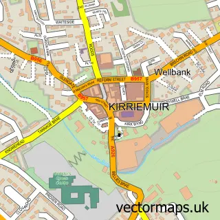
This Glamis street map is a detailed vector street map covering a 750m x 750m area. Select a larger area to create and download your own vector street map of Glamis.
The 750-metre map sample for Glamis covers 124 mapped buildings and approximately 15.8 km of road detail, of which 8 named roads are named. The immediate area includes 1 pub. The wider area around Glamis features 1 tourism point of interest and 3 food and drink venues. To create a larger or custom map of Glamis, the map builder lets you define your own coverage area and download editable SVG, PDF and PNG files.
Create a larger editable map of Glamis
Choose any area you need and generate a high-quality vector map instantly. Perfect for print, planning, design, business and personal use.

This Glamis street map in Angus is available as downloadable SVG, PDF and PNG map files, or as a printed map for planning, business, display, education, local information and design work. You can also create a larger custom map area using the map selector.
What this Glamis map sample shows
Glamis lies within Angus parish, part of Kirriemuir And Dean ward in the Angus local authority area. The postcode geography for this area includes the DD postcode area, the DD8 postcode district and the DD8 1 postcode sector. Residents fall under the Tayside for NHS services.
Local features near Glamis
Within 2 milesAmenities and services in and around Glamis.
Administrative and postcode information for Glamis
Glamis lies within Angus parish, part of Kirriemuir And Dean ward in the Angus local authority area. The postcode geography for this area includes the DD postcode area, the DD8 postcode district and the DD8 1 postcode sector. Residents fall under the Tayside for NHS services.
Nearby street map samples around Glamis


More street maps in Angus
750 metre map area coverage
Boundary, postcode and point of interest information for the 750m x 750m rectangle centred on this sample map.
Boundaries containing map centre
Constituency: Angus and Perthshire Glens Co Const
District: Angus
Icb: Tayside
Postcode District: DD8
Postcode Sector: DD8 1
Ward: Kirriemuir and Dean Ward
Nearby boundaries intersecting sample
No additional intersecting boundaries found.
Postcode coverage
POI category counts
Cafe: 2
Shipping Center: 2
Architectural Designer: 1
Art Museum: 1
Arts And Crafts: 1
Beer Wine And Spirits: 1
Catholic Church: 1
Christmas Trees: 1
Community Services Non Profits: 1
Elementary School: 1
Sample points of interest
- James F Stephen Architects
- Angus Folk Museum
- Glamis Gallery
- Gin Bothy Experience
- The Glamis Corner Shop & Cafe
- The corner shop glamis
- Strathmore
- Strathmore Tree Services
- 61st Glamis Scout Group
- Glamis Primary School
- Glamis manse stone
- Strathmore Arms
Create a larger editable map of Glamis
This sample shows only a 750 metre area. To create a larger map of Glamis, use our map builder to choose your own coverage area, add titles and download editable SVG, PDF and PNG files.
Create a custom map of Glamis