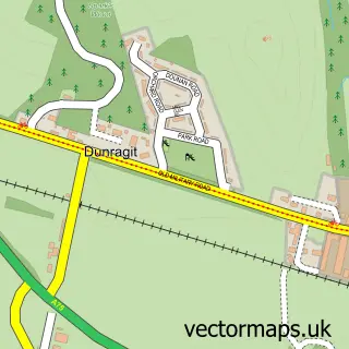
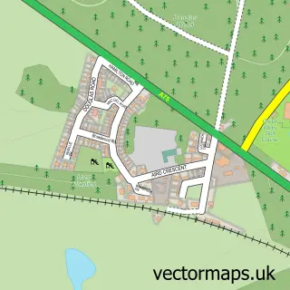
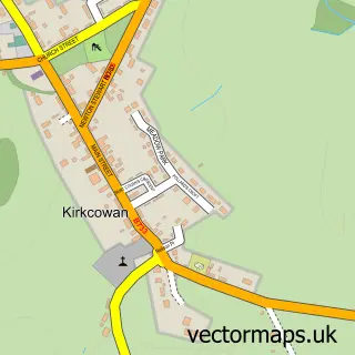
This Glenluce street map is a detailed vector street map covering a 750m x 750m area. Select a larger area to create and download your own vector street map of Glenluce.
The 750-metre map sample for Glenluce covers 153 mapped buildings and approximately 13.2 km of road detail, of which 10 named roads are named. The immediate area includes 1 GP surgery within 2 miles. The wider area around Glenluce features 2 tourism points of interest and 2 hotels. To create a larger or custom map of Glenluce, the map builder lets you define your own coverage area and download editable SVG, PDF and PNG files.
Create a larger editable map of Glenluce
Choose any area you need and generate a high-quality vector map instantly. Perfect for print, planning, design, business and personal use.

This Glenluce street map in Wigtown is available as downloadable SVG, PDF and PNG map files, or as a printed map for planning, business, display, education, local information and design work. You can also create a larger custom map area using the map selector.
What this Glenluce map sample shows
Glenluce lies within Dumfries And Galloway parish, part of Mid Galloway And Wigtown West ward in the Dumfries And Galloway local authority area. The postcode geography for this area includes the DG postcode area, the DG8 postcode district and the DG8 0 postcode sector. Residents fall under the Dumfries And Galloway for NHS services.
Local features near Glenluce
Within 2 milesAmenities and services in and around Glenluce.
Administrative and postcode information for Glenluce
Glenluce lies within Dumfries And Galloway parish, part of Mid Galloway And Wigtown West ward in the Dumfries And Galloway local authority area. The postcode geography for this area includes the DG postcode area, the DG8 postcode district and the DG8 0 postcode sector. Residents fall under the Dumfries And Galloway for NHS services.
Nearby street map samples around Glenluce

More street maps in Wigtown
750 metre map area coverage
Boundary, postcode and point of interest information for the 750m x 750m rectangle centred on this sample map.
Boundaries containing map centre
Constituency: Dumfries and Galloway Co Const
District: Dumfries and Galloway
Icb: Dumfries and Galloway
Postcode District: DG8
Postcode Sector: DG8 0
Ward: Mid Galloway and Wigtown West Ward
Nearby boundaries intersecting sample
No additional intersecting boundaries found.
Postcode coverage
POI category counts
Hotel: 2
Post Office: 2
Arts And Entertainment: 1
Bar: 1
Catholic Church: 1
Charity Organization: 1
Community Center: 1
Convenience Store: 1
Electronics: 1
Elementary School: 1
Sample points of interest
- Glenluce, Scotland.
- River Luce
- Luce Valley
- Grandparents Of Kids With Cancer - Worldwide
- Glenluce Public Hall
- KeyStore More
- Glenluce Computers
- Glenluce Primary School
- Royal Bank of Scotland
- Glenluce Keystore
- Physique 51
- Glenluce Holiday Cottage
Create a larger editable map of Glenluce
This sample shows only a 750 metre area. To create a larger map of Glenluce, use our map builder to choose your own coverage area, add titles and download editable SVG, PDF and PNG files.
Create a custom map of Glenluce