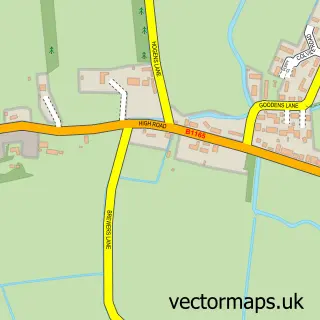
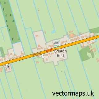
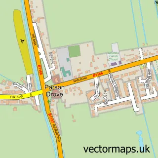
This Gorefield street map is a detailed vector street map covering a 750m x 750m area. Select a larger area to create and download your own vector street map of Gorefield.
The 750-metre map sample for Gorefield covers 267 mapped buildings and approximately 12.1 km of road detail, of which 10 named roads are named. The immediate area includes 1 school, 1 pub and 3 MOT stations within 2 miles. The wider area around Gorefield features 1 tourism point of interest and 1 food and drink venue. To create a larger or custom map of Gorefield, the map builder lets you define your own coverage area and download editable SVG, PDF and PNG files.
Create a larger editable map of Gorefield
Choose any area you need and generate a high-quality vector map instantly. Perfect for print, planning, design, business and personal use.

This Gorefield street map in Cambridgeshire is available as downloadable SVG, PDF and PNG map files, or as a printed map for planning, business, display, education, local information and design work. You can also create a larger custom map area using the map selector.
What this Gorefield map sample shows
Gorefield lies within Gorefield Cp parish, part of Roman Bank ward in the Fenland District local authority area. The postcode geography for this area includes the PE postcode area, the PE13 postcode district and the PE13 4 postcode sector. Residents fall under the Nhs Cambridgeshire And Peterborough Integrated Care Board for NHS services.
Local features near Gorefield
Within 2 milesAmenities and services in and around Gorefield.
Administrative and postcode information for Gorefield
Gorefield lies within Gorefield Cp parish, part of Roman Bank ward in the Fenland District local authority area. The postcode geography for this area includes the PE postcode area, the PE13 postcode district and the PE13 4 postcode sector. Residents fall under the Nhs Cambridgeshire And Peterborough Integrated Care Board for NHS services.
Nearby street map samples around Gorefield

More street maps in Cambridgeshire
750 metre map area coverage
Boundary, postcode and point of interest information for the 750m x 750m rectangle centred on this sample map.
Boundaries containing map centre
Constituency: North East Cambridgeshire Co Const
County: Cambridgeshire County
District: Fenland District
Icb: NHS Central East ICB
Parish: Gorefield CP
Police Force: cambridgeshire
Postcode District: PE13
Postcode Sector: PE13 4
Ward: Parson Drove & Wisbech St. Mary Ward
Nearby boundaries intersecting sample
No additional intersecting boundaries found.
Postcode coverage
POI category counts
Elementary School: 2
Anglican Church: 1
Auto Glass Service: 1
Beauty Product Supplier: 1
Beauty Salon: 1
Butcher Shop: 1
Community Center: 1
Environmental And Ecological Services For Businesses: 1
Gardener: 1
Laundromat: 1
Sample points of interest
- St Paul
- Eastern Frames UK Ltd.
- Choy Par Sharon
- Beautz
- N.V. Gagen
- Gorefield Community Hall and Sports Pavilion
- Gorefield Primary School
- Gorefield Primary School
- A1 Air Testing
- Sam Johnson Landscapes
- Prestige Ironing Company
- David Patrick Plant Hire
Create a larger editable map of Gorefield
This sample shows only a 750 metre area. To create a larger map of Gorefield, use our map builder to choose your own coverage area, add titles and download editable SVG, PDF and PNG files.
Create a custom map of Gorefield