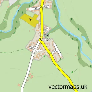
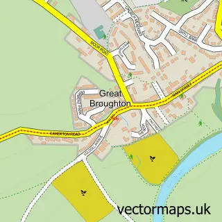
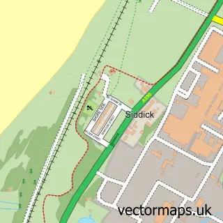
This Great Clifton street map is a detailed vector street map covering a 750m x 750m area. Select a larger area to create and download your own vector street map of Great Clifton.
The 750-metre map sample for Great Clifton covers 225 mapped buildings and approximately 11.2 km of road detail, of which 20 named roads are named. The immediate area includes 2 pubs. The wider area around Great Clifton features 2 food and drink venues. To create a larger or custom map of Great Clifton, the map builder lets you define your own coverage area and download editable SVG, PDF and PNG files.
Create a larger editable map of Great Clifton
Choose any area you need and generate a high-quality vector map instantly. Perfect for print, planning, design, business and personal use.

This Great Clifton street map in Cumbria is available as downloadable SVG, PDF and PNG map files, or as a printed map for planning, business, display, education, local information and design work. You can also create a larger custom map area using the map selector.
What this Great Clifton map sample shows
Great Clifton lies within Great Clifton Cp parish, part of Stainburn & Clifton ward in the Cumberland local authority area. The postcode geography for this area includes the CA postcode area, the CA14 postcode district and the CA14 1 postcode sector. Residents fall under the Nhs North East And North Cumbria Integrated Care Board for NHS services.
Local features near Great Clifton
Within 2 milesAmenities and services in and around Great Clifton.
Administrative and postcode information for Great Clifton
Great Clifton lies within Great Clifton Cp parish, part of Stainburn & Clifton ward in the Cumberland local authority area. The postcode geography for this area includes the CA postcode area, the CA14 postcode district and the CA14 1 postcode sector. Residents fall under the Nhs North East And North Cumbria Integrated Care Board for NHS services.
Nearby street map samples around Great Clifton

More street maps in Cumbria
750 metre map area coverage
Boundary, postcode and point of interest information for the 750m x 750m rectangle centred on this sample map.
Boundaries containing map centre
Constituency: Whitehaven and Workington Co Const
District: Cumberland
Icb: NHS North East and North Cumbria ICB
Parish: Great Clifton CP
Police Force: cumbria
Postcode District: CA14
Postcode Sector: CA14 1
Ward: St. John's and Great Clifton Ward
Nearby boundaries intersecting sample
No additional intersecting boundaries found.
Postcode coverage
POI category counts
Pub: 2
Auto Glass Service: 1
Building Contractor: 1
Cottage: 1
Driving School: 1
Elementary School: 1
Inn: 1
Professional Services: 1
Retirement Home: 1
Shipping Center: 1
Sample points of interest
- Window Repair Cumbria Llp
- Window Repair Cumbria
- White Gables Holiday Cottage
- Peter Gaston School of Motoring
- Derwent Vale Primary School
- The Old Ginn House Inn
- Winscales Parish Council
- Market Cross Inn
- The Old Ginn House Inn Great Clifton Workington
- Clarendon House
- Great Clifton Post Office
- Freefone taxis
Create a larger editable map of Great Clifton
This sample shows only a 750 metre area. To create a larger map of Great Clifton, use our map builder to choose your own coverage area, add titles and download editable SVG, PDF and PNG files.
Create a custom map of Great Clifton