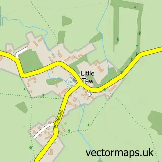
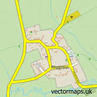
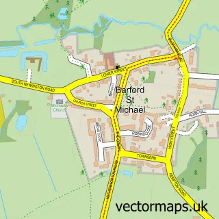
This Great Tew street map is a detailed vector street map covering a 750m x 750m area. Select a larger area to create and download your own vector street map of Great Tew.
The 750-metre map sample for Great Tew covers 60 mapped buildings and approximately 26.3 km of road detail, of which 9 named roads are named. The immediate area includes 1 school and 1 pub. The wider area around Great Tew features 1 tourism point of interest and 1 food and drink venue. To create a larger or custom map of Great Tew, the map builder lets you define your own coverage area and download editable SVG, PDF and PNG files.
Create a larger editable map of Great Tew
Choose any area you need and generate a high-quality vector map instantly. Perfect for print, planning, design, business and personal use.

This Great Tew street map in Oxfordshire is available as downloadable SVG, PDF and PNG map files, or as a printed map for planning, business, display, education, local information and design work. You can also create a larger custom map area using the map selector.
What this Great Tew map sample shows
Great Tew lies within Great Tew Cp parish, part of Kingham, Rollright And Enstone ward in the West Oxfordshire District local authority area. The postcode geography for this area includes the OX postcode area, the OX7 postcode district and the OX7 4 postcode sector. Residents fall under the Nhs Buckinghamshire, Oxfordshire And Berkshire West Integrated Care Board for NHS services.
Local features near Great Tew
Within 2 milesAmenities and services in and around Great Tew.
Administrative and postcode information for Great Tew
The local authority covering Great Tew is West Oxfordshire District, within the county of Oxfordshire. The settlement lies within Kingham, Rollright And Enstone ward and Great Tew Cp civil parish. The OX7 postcode district and OX7 4 postcode sector serve the immediate area. NHS provision in the area is delivered through Oxford University Hospitals Nhs Foundation Trust.
Nearby street map samples around Great Tew

More street maps in Oxfordshire
750 metre map area coverage
Boundary, postcode and point of interest information for the 750m x 750m rectangle centred on this sample map.
Boundaries containing map centre
Constituency: Banbury Co Const
County: Oxfordshire County
District: West Oxfordshire District
Icb: NHS Thames Valley ICB
Parish: Great Tew CP
Police Force: thames valley
Postcode District: OX7
Postcode Sector: OX7 4
Ward: Kingham, Rollright and Enstone Ward
Nearby boundaries intersecting sample
No additional intersecting boundaries found.
Postcode coverage
POI category counts
Bakery: 1
Contractor: 1
Employment Agencies: 1
Farm: 1
Flowers And Gifts Shop: 1
Interior Design: 1
Landmark And Historical Building: 1
Preschool: 1
Pub: 1
Race Track: 1
Sample points of interest
- Baker Girl
- Davies Surfacing
- Sabre Resource Management
- The Great Tew Estate
- Sweetpeas of Great Tew
- Shaun Williams
- Great Tew
- Great Tew Pre-school
- Falkland Arms
- Vision Motorsport Ltd.
Create a larger editable map of Great Tew
This sample shows only a 750 metre area. To create a larger map of Great Tew, use our map builder to choose your own coverage area, add titles and download editable SVG, PDF and PNG files.
Create a custom map of Great Tew