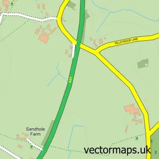
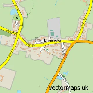
This Grindley Brook street map is a detailed vector street map covering a 750m x 750m area. Select a larger area to create and download your own vector street map of Grindley Brook.
The 750-metre map sample for Grindley Brook covers 84 mapped buildings and approximately 8.5 km of road detail, of which 1 named road are named. The immediate area includes 2 pubs and 1 MOT station, with 3 within 2 miles. The wider area around Grindley Brook features 1 tourism point of interest, 4 food and drink venues and 1 hotel. To create a larger or custom map of Grindley Brook, the map builder lets you define your own coverage area and download editable SVG, PDF and PNG files.
Create a larger editable map of Grindley Brook
Choose any area you need and generate a high-quality vector map instantly. Perfect for print, planning, design, business and personal use.

This Grindley Brook street map in Shropshire is available as downloadable SVG, PDF and PNG map files, or as a printed map for planning, business, display, education, local information and design work. You can also create a larger custom map area using the map selector.
What this Grindley Brook map sample shows
Grindley Brook lies within Whitchurch Urban Cp parish, part of Whitchurch North ward in the Shropshire local authority area. The postcode geography for this area includes the SY postcode area, the SY13 postcode district and the SY13 4 postcode sector. Residents fall under the Nhs Shropshire, Telford And Wrekin Integrated Care Board for NHS services.
Local features near Grindley Brook
Within 2 milesAmenities and services in and around Grindley Brook.
Administrative and postcode information for Grindley Brook
The local authority covering Grindley Brook is Shropshire, within the county of Shropshire. The settlement lies within Whitchurch North ward and Whitchurch Urban Cp civil parish. The SY13 postcode district and SY13 4 postcode sector serve the immediate area. NHS provision in the area is delivered through The Shrewsbury And Telford Hospital Nhs Trust.
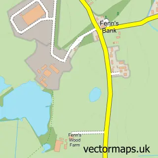
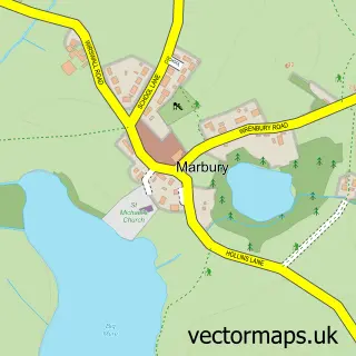
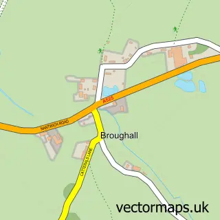
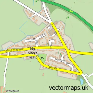
Nearby street map samples around Grindley Brook

More street maps in Shropshire
750 metre map area coverage
Boundary, postcode and point of interest information for the 750m x 750m rectangle centred on this sample map.
Boundaries containing map centre
Constituency: North Shropshire Co Const
District: Shropshire
Icb: NHS Shropshire Telford and Wrekin ICB
Parish: Whitchurch Urban CP
Police Force: west mercia
Postcode District: SY13
Postcode Sector: SY13 4
Nearby boundaries intersecting sample
Constituency: Chester South and Eddisbury Co Const
District: Cheshire West and Chester (B)
Icb: NHS Cheshire and Merseyside ICB
Parish: Agden CP, Tushingham-cum-Grindley, Macefen and Bradley CP
Police Force: cheshire
Ward: Malpas Ward
Postcode coverage
POI category counts
Cafe: 2
Pub: 2
Automotive Repair: 1
Boat Rental And Training: 1
Building Supply Store: 1
Business Manufacturing And Supply: 1
Campground: 1
Canal: 1
Event Planning: 1
Gas Station: 1
Sample points of interest
- D.A. Roberts Fuels
- Drifting Wood Canal Breaks
- Surface Technicians
- D.A.Roberts Fuels Ltd
- Grindley Brook Canalside Cafe
- Lockside Cafe
- Grindley Brook Wharf
- Lane Croft Wharf
- Maxine Beech Ceremonies
- Grindley Brook Garage
- Horse & Jockey
- The Horse and Jockey
Create a larger editable map of Grindley Brook
This sample shows only a 750 metre area. To create a larger map of Grindley Brook, use our map builder to choose your own coverage area, add titles and download editable SVG, PDF and PNG files.
Create a custom map of Grindley Brook