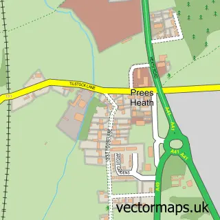
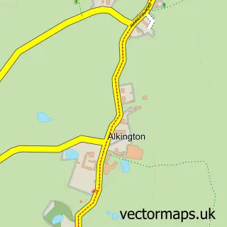
This Tilstock street map is a detailed vector street map covering a 750m x 750m area. Select a larger area to create and download your own vector street map of Tilstock.
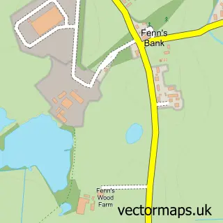
The 750-metre map sample for Tilstock covers 171 mapped buildings and approximately 16.2 km of road detail, of which 8 named roads are named. The immediate area includes 1 school, 1 pub and 1 MOT station, with 2 within 2 miles. The wider area around Tilstock features 1 food and drink venue. To create a larger or custom map of Tilstock, the map builder lets you define your own coverage area and download editable SVG, PDF and PNG files.
Create a larger editable map of Tilstock
Choose any area you need and generate a high-quality vector map instantly. Perfect for print, planning, design, business and personal use.

This Tilstock street map in Shropshire is available as downloadable SVG, PDF and PNG map files, or as a printed map for planning, business, display, education, local information and design work. You can also create a larger custom map area using the map selector.
What this Tilstock map sample shows
Tilstock lies within Whitchurch Rural Cp parish, part of Whitchurch South ward in the Shropshire local authority area. The postcode geography for this area includes the SY postcode area, the SY13 postcode district and the SY13 3 postcode sector. Residents fall under the Nhs Shropshire, Telford And Wrekin Integrated Care Board for NHS services.
Local features near Tilstock
Within 2 milesAmenities and services in and around Tilstock.
Administrative and postcode information for Tilstock
The local authority covering Tilstock is Shropshire, within the county of Shropshire. The settlement lies within Whitchurch South ward and Whitchurch Rural Cp civil parish. The SY13 postcode district and SY13 3 postcode sector serve the immediate area. NHS provision in the area is delivered through The Shrewsbury And Telford Hospital Nhs Trust.
Nearby street map samples around Tilstock

More street maps in Shropshire
750 metre map area coverage
Boundary, postcode and point of interest information for the 750m x 750m rectangle centred on this sample map.
Boundaries containing map centre
Constituency: North Shropshire Co Const
District: Shropshire
Icb: NHS Shropshire Telford and Wrekin ICB
Parish: Whitchurch Rural CP
Police Force: west mercia
Postcode District: SY13
Postcode Sector: SY13 3
Nearby boundaries intersecting sample
No additional intersecting boundaries found.
Postcode coverage
POI category counts
Community Center: 2
Acupuncture: 1
Anglican Church: 1
Automotive Services And Repair: 1
Building Supply Store: 1
Charity Organization: 1
Chimney Sweep: 1
Construction Services: 1
Elementary School: 1
Parking: 1
Sample points of interest
- First Point Acupuncture
- Tilstock Christ Church
- Tilstock Motors
- RGM Construction
- Tilstock Womens Institute
- Quality Chimney Sweep
- Tilstock Village Hall
- Whitewell Community Parish Rooms
- RGM Construction
- Tilstock C Of E Primary School
- Tilstock Ln Parking
- The Horseshoes Inn
Create a larger editable map of Tilstock
This sample shows only a 750 metre area. To create a larger map of Tilstock, use our map builder to choose your own coverage area, add titles and download editable SVG, PDF and PNG files.
Create a custom map of Tilstock