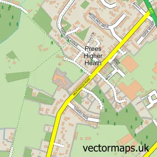
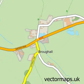
This Prees Heath street map is a detailed vector street map covering a 750m x 750m area. Select a larger area to create and download your own vector street map of Prees Heath.
The 750-metre map sample for Prees Heath covers 129 mapped buildings and approximately 10.9 km of road detail, of which 3 named roads are named. The immediate area includes 1 MOT station, with 4 within 2 miles. The wider area around Prees Heath features 4 food and drink venues and 2 hotels. To create a larger or custom map of Prees Heath, the map builder lets you define your own coverage area and download editable SVG, PDF and PNG files.
Create a larger editable map of Prees Heath
Choose any area you need and generate a high-quality vector map instantly. Perfect for print, planning, design, business and personal use.

This Prees Heath street map in Shropshire is available as downloadable SVG, PDF and PNG map files, or as a printed map for planning, business, display, education, local information and design work. You can also create a larger custom map area using the map selector.
What this Prees Heath map sample shows
Prees Heath lies within Whitchurch Rural Cp parish, part of Whitchurch South ward in the Shropshire local authority area. The postcode geography for this area includes the SY postcode area, the SY13 postcode district and the SY13 2 postcode sector. Residents fall under the Nhs Shropshire, Telford And Wrekin Integrated Care Board for NHS services.
Local features near Prees Heath
Within 2 milesAmenities and services in and around Prees Heath.
Administrative and postcode information for Prees Heath
The local authority covering Prees Heath is Shropshire, within the county of Shropshire. The settlement lies within Whitchurch South ward and Whitchurch Rural Cp civil parish. The SY13 postcode district and SY13 2 postcode sector serve the immediate area. NHS provision in the area is delivered through The Shrewsbury And Telford Hospital Nhs Trust.
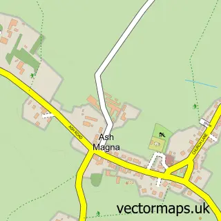
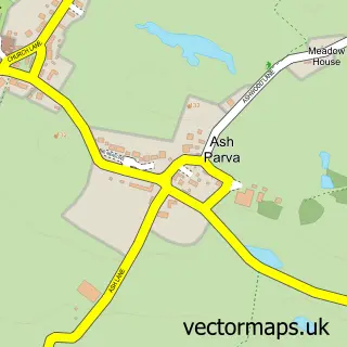
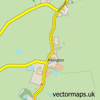
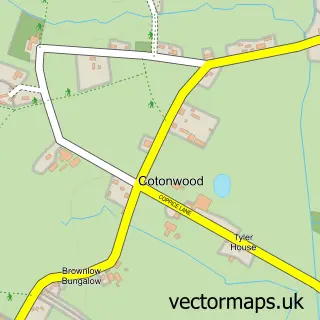
Nearby street map samples around Prees Heath

More street maps in Shropshire
750 metre map area coverage
Boundary, postcode and point of interest information for the 750m x 750m rectangle centred on this sample map.
Boundaries containing map centre
Constituency: North Shropshire Co Const
District: Shropshire
Icb: NHS Shropshire Telford and Wrekin ICB
Parish: Whitchurch Rural CP
Police Force: west mercia
Postcode District: SY13
Postcode Sector: SY13 3
Nearby boundaries intersecting sample
Postcode Sector: SY13 2
Postcode coverage
POI category counts
Cafe: 3
Gas Station: 3
Hotel: 2
Atms: 1
Automotive Repair: 1
Bakery: 1
Coffee Shop: 1
Contractor: 1
Diner: 1
Driving School: 1
Sample points of interest
- ESSO Prees Heath (Rontec - CZC), Sycamore View, Prees Heath
- SB Auto Services
- West Cornwall Pasty Co
- Lynn's Raven Cafe
- Ma Bakers
- Midway Truck Stop
- Raven Cafe
- Sheds Now
- The Midway Truck Stop
- Next Level Driving School
- Prees Fish & Chips
- IML Marine Management
Create a larger editable map of Prees Heath
This sample shows only a 750 metre area. To create a larger map of Prees Heath, use our map builder to choose your own coverage area, add titles and download editable SVG, PDF and PNG files.
Create a custom map of Prees Heath