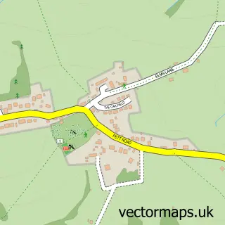
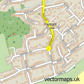
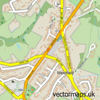
This Guestling Green street map is a detailed vector street map covering a 750m x 750m area. Select a larger area to create and download your own vector street map of Guestling Green.
The 750-metre map sample for Guestling Green covers 74 mapped buildings and approximately 3.8 km of road detail, of which 4 named roads are named. The immediate area includes 1 school, 1 GP surgery within 2 miles and 5 MOT stations within 2 miles. The wider area around Guestling Green features 3 campsites within 2 miles. To create a larger or custom map of Guestling Green, the map builder lets you define your own coverage area and download editable SVG, PDF and PNG files.
Create a larger editable map of Guestling Green
Choose any area you need and generate a high-quality vector map instantly. Perfect for print, planning, design, business and personal use.

This Guestling Green street map in East Sussex is available as downloadable SVG, PDF and PNG map files, or as a printed map for planning, business, display, education, local information and design work. You can also create a larger custom map area using the map selector.
What this Guestling Green map sample shows
Guestling Green lies within Guestling Cp parish, part of Southern Rother ward in the Rother District local authority area. The postcode geography for this area includes the TN postcode area, the TN35 postcode district and the TN35 4 postcode sector. Residents fall under the Nhs Sussex Integrated Care Board for NHS services.
Local features near Guestling Green
Within 2 milesAmenities and services in and around Guestling Green.
Administrative and postcode information for Guestling Green
The local authority covering Guestling Green is Rother District, within the county of East Sussex. The settlement lies within Southern Rother ward and Guestling Cp civil parish. The TN35 postcode district and TN35 4 postcode sector serve the immediate area. NHS provision in the area is delivered through East Sussex Healthcare Nhs Trust.
Nearby street map samples around Guestling Green

More street maps in East Sussex
750 metre map area coverage
Boundary, postcode and point of interest information for the 750m x 750m rectangle centred on this sample map.
Boundaries containing map centre
Constituency: Hastings and Rye Co Const
County: East Sussex County
District: Rother District
Icb: NHS Surrey and Sussex ICB
Parish: Guestling CP
Police Force: sussex
Postcode District: TN35
Postcode Sector: TN35 4
Ward: Southern Rother Ward
Nearby boundaries intersecting sample
No additional intersecting boundaries found.
Postcode coverage
POI category counts
Accommodation: 1
Airport Shuttles: 1
Automotive Repair: 1
Car Dealer: 1
Chimney Sweep: 1
Elementary School: 1
Home Service: 1
Livestock Breeder: 1
Motorcycle Repair: 1
Pet Groomer: 1
Sample points of interest
- Guestling House
- Events Travel Ltd
- Guestling Garage
- Hastings Vehicle Centre
- Hearth & Home
- Guestling Bradshaw C of E Primary School
- Eye See Systems
- Icklesham Koi
- Speedway Motors Mechanical Services
- Guestling Groomers
- Guestling Bradshaw CEP School
- E'S Removals
Create a larger editable map of Guestling Green
This sample shows only a 750 metre area. To create a larger map of Guestling Green, use our map builder to choose your own coverage area, add titles and download editable SVG, PDF and PNG files.
Create a custom map of Guestling Green