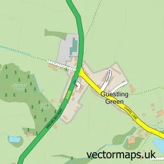
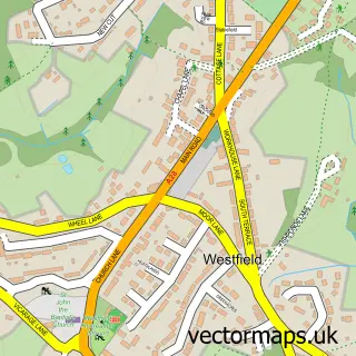
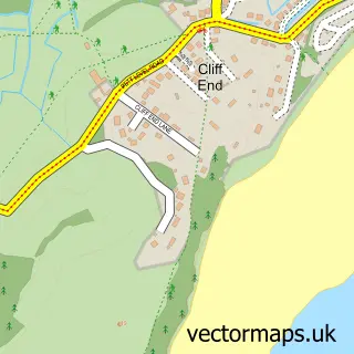
This Hastings street map is a detailed vector street map covering a 750m x 750m area. Select a larger area to create and download your own vector street map of Hastings.
The 750-metre map sample for Hastings covers 82 mapped buildings and approximately 16.1 km of road detail, of which 43 named roads are named. The immediate area includes 1 GP surgery, with 5 within 2 miles, 14 pubs and 15 MOT stations within 2 miles. The wider area around Hastings features 16 tourism points of interest, 56 food and drink venues and 7 hotels. To create a larger or custom map of Hastings, the map builder lets you define your own coverage area and download editable SVG, PDF and PNG files.
Create a larger editable map of Hastings
Choose any area you need and generate a high-quality vector map instantly. Perfect for print, planning, design, business and personal use.

This Hastings street map in East Sussex is available as downloadable SVG, PDF and PNG map files, or as a printed map for planning, business, display, education, local information and design work. You can also create a larger custom map area using the map selector.
What this Hastings map sample shows
Hastings lies within East Sussex County parish, part of Castle ward in the Hastings District (B) local authority area. The postcode geography for this area includes the TN postcode area, the TN34 postcode district and the TN34 1 postcode sector. Residents fall under the Nhs Sussex Integrated Care Board for NHS services.
Local features near Hastings
Within 2 milesAmenities and services in and around Hastings.
Administrative and postcode information for Hastings
The local authority covering Hastings is Hastings District (B), within the county of East Sussex. The settlement lies within Castle ward and East Sussex County civil parish. The TN34 postcode district and TN34 1 postcode sector serve the immediate area. NHS provision in the area is delivered through East Sussex Healthcare Nhs Trust.
Nearby street map samples around Hastings

More street maps in East Sussex
750 metre map area coverage
Boundary, postcode and point of interest information for the 750m x 750m rectangle centred on this sample map.
Boundaries containing map centre
Constituency: Hastings and Rye Co Const
County: East Sussex County
District: Hastings District (B)
Icb: NHS Surrey and Sussex ICB
Police Force: sussex
Postcode District: TN34
Postcode Sector: TN34 1
Ward: Castle Ward
Nearby boundaries intersecting sample
Postcode Sector: TN34 3
Ward: Old Hastings Ward
Postcode coverage
POI category counts
Professional Services: 22
Cafe: 15
Clothing Store: 14
Hair Salon: 14
Jewelry Store: 14
Pub: 14
Real Estate Agent: 14
Restaurant: 14
Charity Organization: 13
Beauty Salon: 12
Sample points of interest
- Hastings Seafront
- The Queens Apartment
- Manningtons
- Russell Accounting
- East Sussex drug And alcohol recovery service (STAR)
- Inside Out Digital Marketing
- Tn38
- Wave Design
- i-Jam Media
- Airport Angels Student Services Ltd
- Dominic Fieldus
- Muscle Moves
Create a larger editable map of Hastings
This sample shows only a 750 metre area. To create a larger map of Hastings, use our map builder to choose your own coverage area, add titles and download editable SVG, PDF and PNG files.
Create a custom map of Hastings