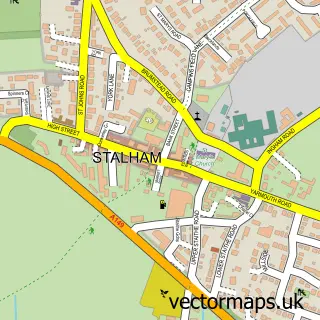
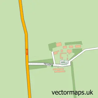
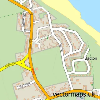
This Happisburgh street map is a detailed vector street map covering a 750m x 750m area. Select a larger area to create and download your own vector street map of Happisburgh.
The 750-metre map sample for Happisburgh covers 165 mapped buildings and approximately 10.4 km of road detail, of which 9 named roads are named. The immediate area includes 1 school and 1 pub. The wider area around Happisburgh features 1 food and drink venue and 3 hotels. To create a larger or custom map of Happisburgh, the map builder lets you define your own coverage area and download editable SVG, PDF and PNG files.
Create a larger editable map of Happisburgh
Choose any area you need and generate a high-quality vector map instantly. Perfect for print, planning, design, business and personal use.

This Happisburgh street map in Norfolk is available as downloadable SVG, PDF and PNG map files, or as a printed map for planning, business, display, education, local information and design work. You can also create a larger custom map area using the map selector.
What this Happisburgh map sample shows
Happisburgh lies within Happisburgh Cp parish, part of Happisburgh ward in the North Norfolk District local authority area. The postcode geography for this area includes the NR postcode area, the NR12 postcode district and the NR12 0 postcode sector. Residents fall under the Nhs Norfolk And Waveney Integrated Care Board for NHS services.
Local features near Happisburgh
Within 2 milesAmenities and services in and around Happisburgh.
Administrative and postcode information for Happisburgh
Happisburgh lies within Happisburgh Cp parish, part of Happisburgh ward in the North Norfolk District local authority area. The postcode geography for this area includes the NR postcode area, the NR12 postcode district and the NR12 0 postcode sector. Residents fall under the Nhs Norfolk And Waveney Integrated Care Board for NHS services.
Nearby street map samples around Happisburgh

More street maps in Norfolk
750 metre map area coverage
Boundary, postcode and point of interest information for the 750m x 750m rectangle centred on this sample map.
Boundaries containing map centre
Constituency: North Norfolk Co Const
County: Norfolk County
District: North Norfolk District
Icb: NHS Norfolk and Waveney ICB
Parish: Happisburgh CP
Police Force: norfolk
Postcode District: NR12
Postcode Sector: NR12 0
Ward: Happisburgh Ward
Nearby boundaries intersecting sample
No additional intersecting boundaries found.
Postcode coverage
POI category counts
Church Cathedral: 3
Hotel: 3
Cottage: 2
Shipping Center: 2
Advertising Agency: 1
Anglican Church: 1
Antique Store: 1
Arts And Entertainment: 1
Caterer: 1
Charity Organization: 1
Sample points of interest
- Liz Dixon Graphic Design
- Happisburgh: St Mary the Virgin
- Clarkes Emporium
- Magic Charlie - the Children's Entertainer
- Village Hall Wenn Evans Centre
- The Broads Society
- Happisburgh Church
- St Mary's Church
- St Marys Church Happisburgh
- Bramble Cottage
- Heather Cottage
- Happisburgh CE VA Primary and Early Years School
Create a larger editable map of Happisburgh
This sample shows only a 750 metre area. To create a larger map of Happisburgh, use our map builder to choose your own coverage area, add titles and download editable SVG, PDF and PNG files.
Create a custom map of Happisburgh