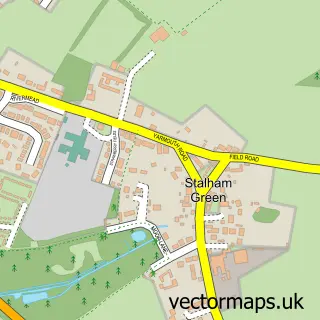
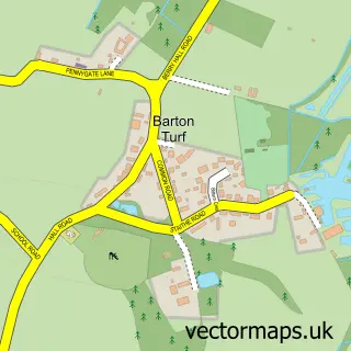
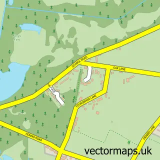
This Stalham street map is a detailed vector street map covering a 750m x 750m area. Select a larger area to create and download your own vector street map of Stalham.
The 750-metre map sample for Stalham covers 418 mapped buildings and approximately 14.5 km of road detail, of which 29 named roads are named. The immediate area includes 1 primary school and 1 secondary school, 1 GP surgery, 3 pubs and 2 MOT stations, with 5 within 2 miles. The wider area around Stalham features 1 tourism point of interest and 8 food and drink venues. To create a larger or custom map of Stalham, the map builder lets you define your own coverage area and download editable SVG, PDF and PNG files.
Create a larger editable map of Stalham
Choose any area you need and generate a high-quality vector map instantly. Perfect for print, planning, design, business and personal use.

This Stalham street map in Norfolk is available as downloadable SVG, PDF and PNG map files, or as a printed map for planning, business, display, education, local information and design work. You can also create a larger custom map area using the map selector.
What this Stalham map sample shows
Stalham lies within Stalham Cp parish, part of Stalham ward in the North Norfolk District local authority area. The postcode geography for this area includes the NR postcode area, the NR12 postcode district and the NR12 9 postcode sector. Residents fall under the Nhs Norfolk And Waveney Integrated Care Board for NHS services.
Local features near Stalham
Within 2 milesAmenities and services in and around Stalham.
Administrative and postcode information for Stalham
Stalham lies within Stalham Cp parish, part of Stalham ward in the North Norfolk District local authority area. The postcode geography for this area includes the NR postcode area, the NR12 postcode district and the NR12 9 postcode sector. Residents fall under the Nhs Norfolk And Waveney Integrated Care Board for NHS services.
Nearby street map samples around Stalham

More street maps in Norfolk
750 metre map area coverage
Boundary, postcode and point of interest information for the 750m x 750m rectangle centred on this sample map.
Boundaries containing map centre
Constituency: North Norfolk Co Const
County: Norfolk County
District: North Norfolk District
Icb: NHS Norfolk and Waveney ICB
Parish: Stalham CP
Police Force: norfolk
Postcode District: NR12
Postcode Sector: NR12 9
Ward: Stalham Ward
Nearby boundaries intersecting sample
No additional intersecting boundaries found.
Postcode coverage
POI category counts
Beauty Salon: 9
Beauty And Spa: 4
Cafe: 4
Carpet Store: 3
Chinese Restaurant: 3
Flowers And Gifts Shop: 3
Hair Salon: 3
Indian Restaurant: 3
Professional Services: 3
Pub: 3
Sample points of interest
- Stalham Broads Walking Netball Club
- St. Mary's Church
- Stalham St Mary
- Break Charity Shop
- Stalham Antique Gallery
- Stalham Radio Ltd.
- ATM (Post Office)
- PayPoint
- Broadland Hearing Care
- Motor-Man
- DLH AutoCentre
- Nicholsons Garage
Create a larger editable map of Stalham
This sample shows only a 750 metre area. To create a larger map of Stalham, use our map builder to choose your own coverage area, add titles and download editable SVG, PDF and PNG files.
Create a custom map of Stalham