Vector Maps logo
Home Why it works Popular maps Districts Samples Customizer Create Your Map
VectorMaps.uk
Home Popular maps Districts Samples Customizer Create Your Map Privacy Disclaimer
Home / UK Maps / Dunbartonshire / Hardgate Map

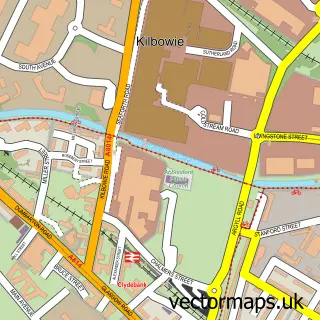
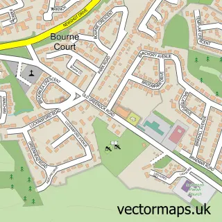
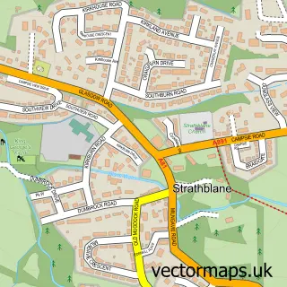
This Hardgate street map is a detailed vector street map covering a 750m x 750m area. Select a larger area to create and download your own vector street map of Hardgate.

Hardgate is a village in Dunbartonshire, in the West Scotland of Scotland. The settlement falls within the West Dunbartonshire parliamentary constituency. It is served by the G81 postcode district, with G81 6 as the local postcode sector.

The 750-metre map sample for Hardgate covers 313 mapped buildings and approximately 15.8 km of road detail, of which 29 named roads are named. The immediate area includes 11 GP surgeries within 2 miles, 2 pubs and 1 MOT station, with 11 within 2 miles. The wider area around Hardgate features 1 tourism point of interest and 7 food and drink venues. To create a larger or custom map of Hardgate, the map builder lets you define your own coverage area and download editable SVG, PDF and PNG files.

313Buildings
15.75 kmRoads
29Named roads
0Residents within 2 miles
Create your own

Create a larger editable map of Hardgate

Choose any area you need and generate a high-quality vector map instantly. Perfect for print, planning, design, business and personal use.

Choose any location
Editable SVG files
Any size up to A0
PDF, PNG & more
Instant download
High quality guaranteed
Create My Custom Map
Secure, private & no credit card required
Hardgate Vector Street Map
750m Sample
Hardgate vector street map sample showing roads, buildings and local features in a 750 metre preview area
Buy Hardgate Map Print from £12.95 Buy Hardgate Digital Map from £6

This Hardgate street map in Dunbartonshire is available as downloadable SVG, PDF and PNG map files, or as a printed map for planning, business, display, education, local information and design work. You can also create a larger custom map area using the map selector.

What this Hardgate map sample shows

Hardgate lies within West Dunbartonshire parish, part of Kilpatrick ward in the West Dunbartonshire local authority area. The postcode geography for this area includes the G postcode area, the G81 postcode district and the G81 6 postcode sector. Residents fall under the Greater Glasgow And Clyde for NHS services.

Local features near Hardgate

Within 2 miles

Amenities and services in and around Hardgate.

11 GP surgeries within 2 miles
1 MOT stations 11 within 2 miles
1 Tourism & leisure
7 Food & drink
2 Pubs
6 Healthcare POIs
1 Vehicle services

Counts are approximate and based on publicly available data.

Administrative and postcode information for Hardgate

The local authority covering Hardgate is West Dunbartonshire, within the county of Dunbartonshire. The settlement lies within Kilpatrick ward and West Dunbartonshire civil parish. The G81 postcode district and G81 6 postcode sector serve the immediate area. NHS provision in the area is delivered through Greater Glasgow And Clyde.

Parish WEST DUNBARTONSHIRE
Ward Kilpatrick
District / local authority West Dunbartonshire
County Dunbartonshire
Historic county Dunbartonshire
Postcode district G81
Postcode sector G81 6
Parliamentary constituency West Dunbartonshire
Region West Scotland
Country Scotland

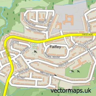
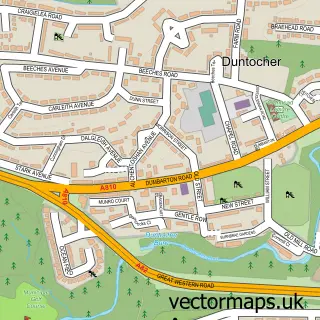
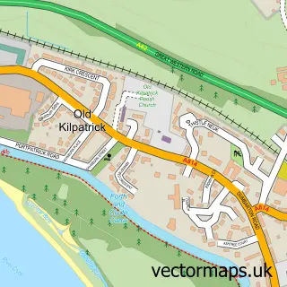
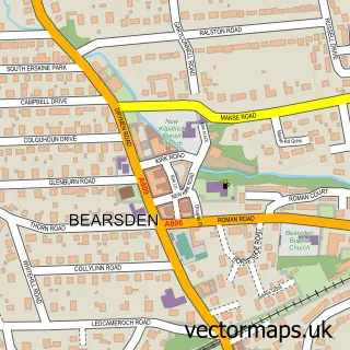
Nearby street map samples around Hardgate

Street map sample of Clydebank, Dunbartonshire Clydebank Town - Dunbartonshire - 1.5 miles Street map sample of Glasgow, City of Glasgow Glasgow City - City of Glasgow - 7.3 miles Street map sample of Faifley, Dunbartonshire Faifley Village - Dunbartonshire - 0.3 miles Street map sample of Duntocher, Dunbartonshire Duntocher Village - Dunbartonshire - 0.8 miles Street map sample of Old Kilpatrick, Dunbartonshire Old Kilpatrick Village - Dunbartonshire - 2.4 miles Street map sample of Inchinnan, Renfrewshire Inchinnan Village - Renfrewshire - 2.7 miles Street map sample of Bowling, Dunbartonshire Bowling Village - Dunbartonshire - 3.3 miles Street map sample of Milton, Dunbartonshire Milton Village - Dunbartonshire - 4.7 miles Street map sample of Blanefield, Stirling and Falkirk Blanefield Village - Stirling and Falkirk - 5.5 miles Street map sample of Strathblane, Stirling and Falkirk Strathblane Village - Stirling and Falkirk - 5.6 miles

More street maps in Dunbartonshire

Street map sample of Faifley, Dunbartonshire Faifley Village - 0.3 miles Street map sample of Duntocher, Dunbartonshire Duntocher Village - 0.8 miles Street map sample of Clydebank, Dunbartonshire Clydebank Town - 1.5 miles Street map sample of Old Kilpatrick, Dunbartonshire Old Kilpatrick Village - 2.4 miles Street map sample of Bearsden, Dunbartonshire Bearsden Town - 2.6 miles

750 metre map area coverage

Boundary, postcode and point of interest information for the 750m x 750m rectangle centred on this sample map.

Boundaries containing map centre

Constituency: West Dunbartonshire Co Const

District: West Dunbartonshire

Icb: Greater Glasgow and Clyde

Postcode District: G81

Postcode Sector: G81 5

Ward: Kilpatrick Ward

Nearby boundaries intersecting sample

Postcode Sector: G81 6

Postcode coverage

G81 G81 5 G81 6

POI category counts

Beauty Salon: 3

Betting Center: 3

Chinese Restaurant: 3

Convenience Store: 3

Dentist: 3

Restaurant: 3

Barber: 2

Car Dealer: 2

Car Rental Agency: 2

Elementary School: 2

Sample points of interest

  • Greggs Bakery
  • RBS Bank Credit Union
  • Costa del Beechwood Bar
  • Little India Takeaway Barbecue Restaurant
  • Kurdish Barber Barber
  • Trimms Barber
  • Lesley & Amy at Trimms Beauty And Spa
  • Karen MacCulloch Aesthetics Beauty Salon
  • Kirsty Mulholland Beauty Beauty Salon
  • Skypoint Cut Above Beauty Salon
  • Ladbrokes Betting Center
  • William Hill Betting Center

Create a larger editable map of Hardgate

This sample shows only a 750 metre area. To create a larger map of Hardgate, use our map builder to choose your own coverage area, add titles and download editable SVG, PDF and PNG files.

Create a custom map of Hardgate

Phone 01751 473136 | Copyright Vectormaps.uk 2026

Samples Customizer Privacy Disclaimer
Hardgate Vector Street Map
Hardgate enlarged street map sample showing a 750 metre preview area