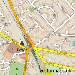
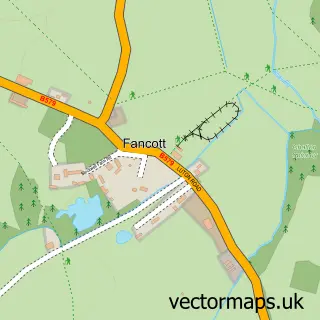
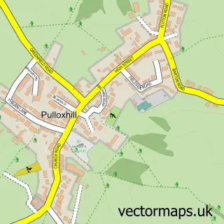
This Harlington street map is a detailed vector street map covering a 750m x 750m area. Select a larger area to create and download your own vector street map of Harlington.
The 750-metre map sample for Harlington covers 349 mapped buildings and approximately 12.3 km of road detail, of which 27 named roads are named. The immediate area includes 1 primary school and 1 secondary school, 1 railway station and 2 pubs. The wider area around Harlington features 1 tourism point of interest and 4 food and drink venues. To create a larger or custom map of Harlington, the map builder lets you define your own coverage area and download editable SVG, PDF and PNG files.
Create a larger editable map of Harlington
Choose any area you need and generate a high-quality vector map instantly. Perfect for print, planning, design, business and personal use.

This Harlington street map in Bedfordshire is available as downloadable SVG, PDF and PNG map files, or as a printed map for planning, business, display, education, local information and design work. You can also create a larger custom map area using the map selector.
What this Harlington map sample shows
Harlington lies within Harlington Cp parish, part of Toddington ward in the Central Bedfordshire local authority area. The postcode geography for this area includes the LU postcode area, the LU5 postcode district and the LU5 6 postcode sector. Residents fall under the Nhs Bedfordshire, Luton And Milton Keynes Integrated Care Board for NHS services.
Local features near Harlington
Within 2 milesAmenities and services in and around Harlington.
Administrative and postcode information for Harlington
The local authority covering Harlington is Central Bedfordshire, within the county of Bedfordshire. The settlement lies within Toddington ward and Harlington Cp civil parish. The LU5 postcode district and LU5 6 postcode sector serve the immediate area. NHS provision in the area is delivered through Bedfordshire Hospitals Nhs Foundation Trust.
Nearby street map samples around Harlington

More street maps in Bedfordshire
750 metre map area coverage
Boundary, postcode and point of interest information for the 750m x 750m rectangle centred on this sample map.
Boundaries containing map centre
Constituency: Mid Bedfordshire Co Const
District: Central Bedfordshire
Icb: NHS Central East ICB
Parish: Harlington CP
Police Force: bedfordshire
Postcode District: LU5
Postcode Sector: LU5 6
Ward: Toddington Ward
Nearby boundaries intersecting sample
No additional intersecting boundaries found.
Postcode coverage
POI category counts
Train Station: 4
Anglican Church: 2
Building Supply Store: 2
Business Management Services: 2
Cafe: 2
Doctor: 2
Hair Salon: 2
Korean Grocery Store: 2
Package Locker: 2
Pub: 2
Sample points of interest
- St Mary's Church
- St Mary's Harlington
- Headstrong Hair Studio
- Harlington Manor
- I M Clayton Plumbing & Heating
- Sarrifton Solutions
- Oakhaven Business Development Ltd.
- Wobbleco Music Ltd.
- Hub And Spoke Cafe
- The Hub & Spoke Cafe
- Church of Saint Mary the Virgin, Harlington, Bedfordshire
- Harlington Village Hall
Create a larger editable map of Harlington
This sample shows only a 750 metre area. To create a larger map of Harlington, use our map builder to choose your own coverage area, add titles and download editable SVG, PDF and PNG files.
Create a custom map of Harlington