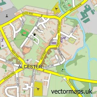
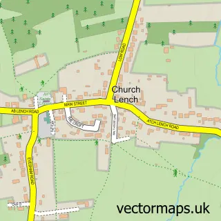
This Inkberrow street map is a detailed vector street map covering a 750m x 750m area. Select a larger area to create and download your own vector street map of Inkberrow.
The 750-metre map sample for Inkberrow covers 307 mapped buildings and approximately 21.2 km of road detail, of which 24 named roads are named. The immediate area includes 1 GP surgery within 2 miles and 2 pubs. The wider area around Inkberrow features 2 tourism points of interest and 2 food and drink venues. To create a larger or custom map of Inkberrow, the map builder lets you define your own coverage area and download editable SVG, PDF and PNG files.
Create a larger editable map of Inkberrow
Choose any area you need and generate a high-quality vector map instantly. Perfect for print, planning, design, business and personal use.

This Inkberrow street map in Worcestershire is available as downloadable SVG, PDF and PNG map files, or as a printed map for planning, business, display, education, local information and design work. You can also create a larger custom map area using the map selector.
What this Inkberrow map sample shows
Inkberrow lies within Inkberrow Cp parish, part of Inkberrow ward in the Wychavon District local authority area. The postcode geography for this area includes the WR postcode area, the WR7 postcode district and the WR7 4 postcode sector. Residents fall under the Nhs Herefordshire And Worcestershire Integrated Care Board for NHS services.
Local features near Inkberrow
Within 2 milesAmenities and services in and around Inkberrow.
Administrative and postcode information for Inkberrow
Inkberrow lies within Inkberrow Cp parish, part of Inkberrow ward in the Wychavon District local authority area. The postcode geography for this area includes the WR postcode area, the WR7 postcode district and the WR7 4 postcode sector. Residents fall under the Nhs Herefordshire And Worcestershire Integrated Care Board for NHS services.
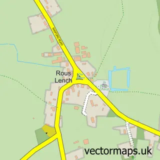
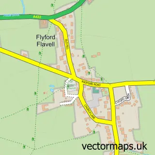
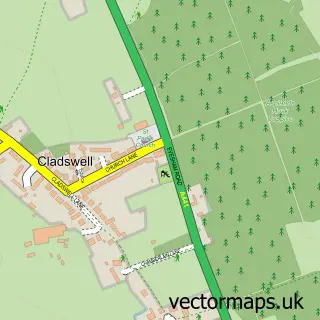
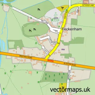
Nearby street map samples around Inkberrow

More street maps in Worcestershire
750 metre map area coverage
Boundary, postcode and point of interest information for the 750m x 750m rectangle centred on this sample map.
Boundaries containing map centre
Constituency: Redditch Co Const
County: Worcestershire County
District: Wychavon District
Icb: NHS Herefordshire and Worcestershire ICB
Parish: Inkberrow CP
Police Force: west mercia
Postcode District: WR7
Postcode Sector: WR7 4
Ward: Inkberrow Ward
Nearby boundaries intersecting sample
No additional intersecting boundaries found.
Postcode coverage
POI category counts
Beauty Salon: 4
Convenience Store: 3
Bed And Breakfast: 2
Korean Grocery Store: 2
Pub: 2
Anglican Church: 1
Arts And Entertainment: 1
Automotive Repair: 1
Business: 1
Business Consulting: 1
Sample points of interest
- St Peter
- John R Harris
- Vehicle Inspection Service - Inkberrow Ltd
- Annabel’s Hair
- EJ Beauty
- The Hair Lounge
- Waterside Health & Beauty - Inkberrow
- Bowers Hill Farm B&B
- Bulls Head Inn
- Eotr Solutions
- People Perfect
- Inkberrow Castle
Create a larger editable map of Inkberrow
This sample shows only a 750 metre area. To create a larger map of Inkberrow, use our map builder to choose your own coverage area, add titles and download editable SVG, PDF and PNG files.
Create a custom map of Inkberrow