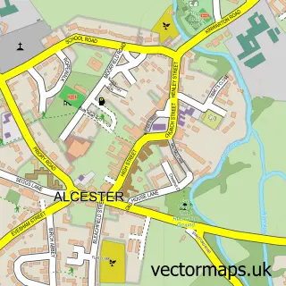
This Rous Lench street map is a detailed vector street map covering a 750m x 750m area. Select a larger area to create and download your own vector street map of Rous Lench.
The 750-metre map sample for Rous Lench covers 86 mapped buildings and approximately 20.7 km of road detail, of which 1 named road are named. The wider area around Rous Lench features 1 tourism point of interest. To create a larger or custom map of Rous Lench, the map builder lets you define your own coverage area and download editable SVG, PDF and PNG files.
Create a larger editable map of Rous Lench
Choose any area you need and generate a high-quality vector map instantly. Perfect for print, planning, design, business and personal use.

This Rous Lench street map in Worcestershire is available as downloadable SVG, PDF and PNG map files, or as a printed map for planning, business, display, education, local information and design work. You can also create a larger custom map area using the map selector.
What this Rous Lench map sample shows
Rous Lench lies within Rous Lench Cp parish, part of Inkberrow ward in the Wychavon District local authority area. The postcode geography for this area includes the WR postcode area, the WR11 postcode district and the WR11 4 postcode sector. Residents fall under the Nhs Herefordshire And Worcestershire Integrated Care Board for NHS services.
Local features near Rous Lench
Within 2 milesAmenities and services in and around Rous Lench.
Administrative and postcode information for Rous Lench
The local authority covering Rous Lench is Wychavon District, within the county of Worcestershire. The settlement lies within Inkberrow ward and Rous Lench Cp civil parish. The WR11 postcode district and WR11 4 postcode sector serve the immediate area. NHS provision in the area is delivered through Worcestershire Acute Hospitals Nhs Trust.
Nearby street map samples around Rous Lench

More street maps in Worcestershire
750 metre map area coverage
Boundary, postcode and point of interest information for the 750m x 750m rectangle centred on this sample map.
Boundaries containing map centre
Constituency: Redditch Co Const
County: Worcestershire County
District: Wychavon District
Icb: NHS Herefordshire and Worcestershire ICB
Parish: Rous Lench CP
Police Force: west mercia
Postcode District: WR11
Postcode Sector: WR11 4
Ward: Inkberrow Ward
Nearby boundaries intersecting sample
No additional intersecting boundaries found.
Postcode coverage
POI category counts
Advertising Agency: 1
Anglican Church: 1
Attractions And Activities: 1
Car Dealer: 1
Community Center: 1
Farm: 1
Public Service And Government: 1
Publicity Service: 1
Recreational Vehicle Dealer: 1
Stadium Arena: 1
Sample points of interest
- SEED Marketing Communications
- St Peter
- Rous Lench Allotments and Community Gardens
- V W Direct Worcester Limited
- Rous Lench Village Hall
- S H Smith and Sons
- Rous Lench Parish Council
- Seed Marketing Communications Ltd.
- Hazlewood Trailers
- Els Europe
Create a larger editable map of Rous Lench
This sample shows only a 750 metre area. To create a larger map of Rous Lench, use our map builder to choose your own coverage area, add titles and download editable SVG, PDF and PNG files.
Create a custom map of Rous Lench