Vector Maps logo
Home Why it works Popular maps Districts Samples Customizer Create Your Map
VectorMaps.uk
Home Popular maps Districts Samples Customizer Create Your Map Privacy Disclaimer
Home / UK Maps / Argyll and Bute / Inveraray Map

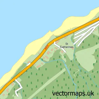
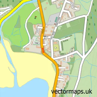
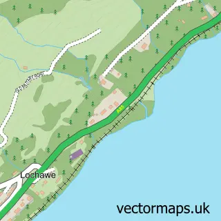
This Inveraray street map is a detailed vector street map covering a 750m x 750m area. Select a larger area to create and download your own vector street map of Inveraray.

Inveraray is a town in Argyll And Bute, in the Highlands And Islands of Scotland. Historically, the area formed part of Argyllshire. The settlement falls within the Argyll And Bute parliamentary constituency. It is served by the PA32 postcode district, wi

The 750-metre map sample for Inveraray covers 34 mapped buildings and approximately 11.5 km of road detail, of which 9 named roads are named. The immediate area includes 1 GP surgery, 1 pub and 1 MOT station. The wider area around Inveraray features 5 tourism points of interest, 9 food and drink venues and 9 hotels. To create a larger or custom map of Inveraray, the map builder lets you define your own coverage area and download editable SVG, PDF and PNG files.

34Buildings
11.51 kmRoads
9Named roads
0Residents within 2 miles
Create your own

Create a larger editable map of Inveraray

Choose any area you need and generate a high-quality vector map instantly. Perfect for print, planning, design, business and personal use.

Choose any location
Editable SVG files
Any size up to A0
PDF, PNG & more
Instant download
High quality guaranteed
Create My Custom Map
Secure, private & no credit card required
Inveraray Vector Street Map
750m Sample
Inveraray vector street map sample showing roads, buildings and local features in a 750 metre preview area
Buy Inveraray Map Print from £12.95 Buy Inveraray Digital Map from £6

This Inveraray street map in Argyll and Bute is available as downloadable SVG, PDF and PNG map files, or as a printed map for planning, business, display, education, local information and design work. You can also create a larger custom map area using the map selector.

What this Inveraray map sample shows

Inveraray lies within Argyll And Bute parish, part of Mid Argyll ward in the Argyll And Bute local authority area. The postcode geography for this area includes the PA postcode area, the PA32 postcode district and the PA32 8 postcode sector. Residents fall under the Highland for NHS services.

Local features near Inveraray

Within 2 miles

Amenities and services in and around Inveraray.

1 GP surgeries 1 within 2 miles
1 MOT stations 1 within 2 miles
5 Tourism & leisure
9 Food & drink
1 Pubs
9 Hotels
2 Healthcare POIs
1 Vehicle services

Counts are approximate and based on publicly available data.

Administrative and postcode information for Inveraray

Inveraray lies within Argyll And Bute parish, part of Mid Argyll ward in the Argyll And Bute local authority area. The postcode geography for this area includes the PA postcode area, the PA32 postcode district and the PA32 8 postcode sector. Residents fall under the Highland for NHS services.

Parish ARGYLL AND BUTE
Ward Mid Argyll
District / local authority Argyll and Bute
County Argyll and Bute
Historic county Argyllshire
Postcode district PA32
Postcode sector PA32 8
Parliamentary constituency Argyll and Bute
Region Highlands and Islands
Country Scotland

Nearby street map samples around Inveraray

Street map sample of Glasgow, City of Glasgow Glasgow City - City of Glasgow - 40.7 miles Street map sample of St Catherines, Argyll and Bute St Catherines Village - Argyll and Bute - 1.7 miles Street map sample of Strachur, Argyll and Bute Strachur Village - Argyll and Bute - 4.4 miles Street map sample of Cairndow, Argyll and Bute Cairndow Village - Argyll and Bute - 5.4 miles Street map sample of Furnace, Argyll and Bute Furnace Village - Argyll and Bute - 6.9 miles Street map sample of Lochgoilhead, Argyll and Bute Lochgoilhead Village - Argyll and Bute - 7.7 miles Street map sample of Dalavich, Argyll and Bute Dalavich Village - Argyll and Bute - 8.3 miles Street map sample of Minard, Argyll and Bute Minard Village - Argyll and Bute - 10.4 miles Street map sample of Carrick Castle, Argyll and Bute Carrick Castle Village - Argyll and Bute - 10.6 miles Street map sample of Lochawe, Argyll and Bute Lochawe Village - Argyll and Bute - 11.5 miles

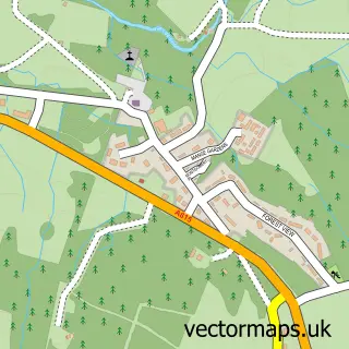
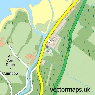
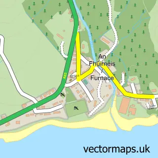
More street maps in Argyll and Bute

Street map sample of St Catherines, Argyll and Bute St Catherines Village - 1.7 miles Street map sample of Strachur, Argyll and Bute Strachur Village - 4.4 miles Street map sample of Cairndow, Argyll and Bute Cairndow Village - 5.4 miles Street map sample of Furnace, Argyll and Bute Furnace Village - 6.9 miles Street map sample of Lochgoilhead, Argyll and Bute Lochgoilhead Village - 7.7 miles

750 metre map area coverage

Boundary, postcode and point of interest information for the 750m x 750m rectangle centred on this sample map.

Boundaries containing map centre

Constituency: Argyll, Bute and South Lochaber Co Const

District: Argyll and Bute

Postcode District: PA32

Postcode Sector: PA32 8

Ward: Mid Argyll Ward

Nearby boundaries intersecting sample

Icb: Highland

Postcode coverage

PA32 PA32 8

POI category counts

Hotel: 9

Flowers And Gifts Shop: 7

Grocery Store: 4

Restaurant: 4

Cafe: 3

Clothing Store: 3

Landmark And Historical Building: 3

Bed And Breakfast: 2

Candy Store: 2

Car Dealer: 2

Sample points of interest

  • The Stable Gallery Art Gallery
  • The Cooperative Food Inverary The Avenue Atms
  • WD Semple Automotive Dealer
  • RBS Bank Credit Union
  • Purdie's of Argyll Beauty And Spa
  • Inveraray Townhouse & Loft Bed And Breakfast
  • Inveraray Townhouse and Loft Bed And Breakfast
  • Cottage Restaurant British Restaurant
  • Brambles Cafe & Bistro Cafe
  • The Green Door Cafe
  • The Kintyre Cafe
  • Sweet Memories Candy Store

Create a larger editable map of Inveraray

This sample shows only a 750 metre area. To create a larger map of Inveraray, use our map builder to choose your own coverage area, add titles and download editable SVG, PDF and PNG files.

Create a custom map of Inveraray

Phone 01751 473136 | Copyright Vectormaps.uk 2026

Samples Customizer Privacy Disclaimer
Inveraray Vector Street Map
Inveraray enlarged street map sample showing a 750 metre preview area