Vector Maps logo
Home Why it works Popular maps Districts Samples Customizer Create Your Map
VectorMaps.uk
Home Popular maps Districts Samples Customizer Create Your Map Privacy Disclaimer
Home / UK Maps / Stirling and Falkirk / Killin Map

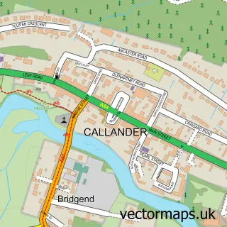
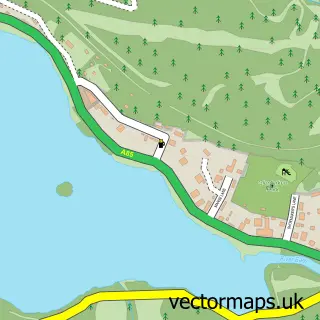
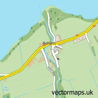
This Killin street map is a detailed vector street map covering a 750m x 750m area. Select a larger area to create and download your own vector street map of Killin.

Killin is a village in Stirling And Falkirk, in the Mid Scotland And Fife of Scotland. Historically, the area formed part of Perthshire. The settlement falls within the Stirling parliamentary constituency. It is served by the FK21 postcode district, with

The 750-metre map sample for Killin covers 115 mapped buildings and approximately 9.9 km of road detail, of which 10 named roads are named. The immediate area includes 1 GP surgery and 1 MOT station within 2 miles. The wider area around Killin features 2 tourism points of interest, 1 food and drink venue and 7 hotels. To create a larger or custom map of Killin, the map builder lets you define your own coverage area and download editable SVG, PDF and PNG files.

115Buildings
9.92 kmRoads
10Named roads
0Residents within 2 miles
Create your own

Create a larger editable map of Killin

Choose any area you need and generate a high-quality vector map instantly. Perfect for print, planning, design, business and personal use.

Choose any location
Editable SVG files
Any size up to A0
PDF, PNG & more
Instant download
High quality guaranteed
Create My Custom Map
Secure, private & no credit card required
Killin Vector Street Map
750m Sample
Killin vector street map sample showing roads, buildings and local features in a 750 metre preview area
Buy Killin Map Print from £12.95 Buy Killin Digital Map from £6

This Killin street map in Stirling and Falkirk is available as downloadable SVG, PDF and PNG map files, or as a printed map for planning, business, display, education, local information and design work. You can also create a larger custom map area using the map selector.

What this Killin map sample shows

Killin lies within Stirling parish, part of Trossachs And Teith ward in the Stirling local authority area. The postcode geography for this area includes the FK postcode area, the FK21 postcode district and the FK21 8 postcode sector. Residents fall under the Forth Valley for NHS services.

Local features near Killin

Within 2 miles

Amenities and services in and around Killin.

1 Campsites within 2 miles
1 GP surgeries 1 within 2 miles
1 MOT stations within 2 miles
2 Tourism & leisure
1 Food & drink
7 Hotels
3 Healthcare POIs

Counts are approximate and based on publicly available data.

Administrative and postcode information for Killin

Killin lies within Stirling parish, part of Trossachs And Teith ward in the Stirling local authority area. The postcode geography for this area includes the FK postcode area, the FK21 postcode district and the FK21 8 postcode sector. Residents fall under the Forth Valley for NHS services.

Parish STIRLING
Ward Trossachs and Teith
District / local authority Stirling
County Stirling and Falkirk
Historic county Perthshire
Postcode district FK21
Postcode sector FK21 8
Parliamentary constituency Stirling
Region Mid Scotland and Fife
Country Scotland

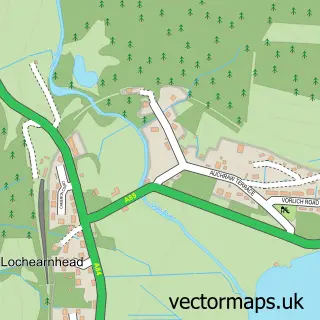
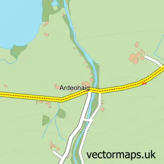
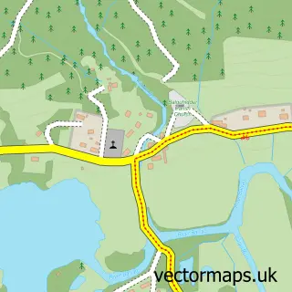
Nearby street map samples around Killin

Street map sample of Callander, Stirling and Falkirk Callander Town - Stirling and Falkirk - 15.9 miles Street map sample of Stirling, Stirling and Falkirk Stirling City - Stirling and Falkirk - 28.2 miles Street map sample of Lochearnhead, Stirling and Falkirk Lochearnhead Village - Stirling and Falkirk - 5.7 miles Street map sample of Ardeonaig, Stirling and Falkirk Ardeonaig Village - Stirling and Falkirk - 6.2 miles Street map sample of Balquhidder, Stirling and Falkirk Balquhidder Village - Stirling and Falkirk - 7.8 miles Street map sample of St Fillans, Perth and Kinross St Fillans Village - Perth and Kinross - 9.2 miles Street map sample of Strathyre, Stirling and Falkirk Strathyre Village - Stirling and Falkirk - 9.9 miles Street map sample of Feàrnan, Perth and Kinross Feàrnan Village - Perth and Kinross - 11.9 miles Street map sample of Crianlarich, Stirling and Falkirk Crianlarich Village - Stirling and Falkirk - 12.4 miles Street map sample of Acharn, Perth and Kinross Acharn Village - Perth and Kinross - 13.3 miles

More street maps in Stirling and Falkirk

Street map sample of Lochearnhead, Stirling and Falkirk Lochearnhead Village - 5.7 miles Street map sample of Ardeonaig, Stirling and Falkirk Ardeonaig Village - 6.2 miles Street map sample of Balquhidder, Stirling and Falkirk Balquhidder Village - 7.8 miles Street map sample of Strathyre, Stirling and Falkirk Strathyre Village - 9.9 miles Street map sample of Crianlarich, Stirling and Falkirk Crianlarich Village - 12.4 miles

750 metre map area coverage

Boundary, postcode and point of interest information for the 750m x 750m rectangle centred on this sample map.

Boundaries containing map centre

Constituency: Stirling and Strathallan Co Const

District: Stirling

Icb: Forth Valley

Postcode District: FK21

Postcode Sector: FK21 8

Ward: Trossachs and Teith Ward

Nearby boundaries intersecting sample

No additional intersecting boundaries found.

Postcode coverage

FK21 FK21 8

POI category counts

Hotel: 7

Bed And Breakfast: 6

Holiday Rental Home: 3

Professional Services: 3

Elementary School: 2

Flowers And Gifts Shop: 2

Laundromat: 2

Library: 2

Pizza Restaurant: 2

Post Office: 2

Sample points of interest

  • Shutters Restaurant American Restaurant
  • Bank of Scotland Bank Credit Union
  • Breadalbane House Bed And Breakfast
  • Craigbuie Guest House Bed And Breakfast
  • Dall Lodge Country House Bed And Breakfast
  • Lochleven B&B Killin Bed And Breakfast
  • Lochleven Bed and Breakfast Bed And Breakfast
  • The Old Bank Bed And Breakfast
  • Dochart Viaduct Bridge
  • Trossachs Radio Broadcasting Media Production
  • Eco Carpet & Upholstery Cleaning Building Supply Store
  • Eternal Mountain Business Management Services

Create a larger editable map of Killin

This sample shows only a 750 metre area. To create a larger map of Killin, use our map builder to choose your own coverage area, add titles and download editable SVG, PDF and PNG files.

Create a custom map of Killin

Phone 01751 473136 | Copyright Vectormaps.uk 2026

Samples Customizer Privacy Disclaimer
Killin Vector Street Map
Killin enlarged street map sample showing a 750 metre preview area