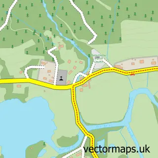
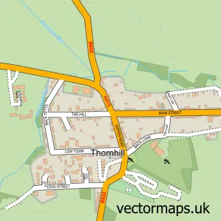
This Strathyre street map is a detailed vector street map covering a 750m x 750m area. Select a larger area to create and download your own vector street map of Strathyre.
The 750-metre map sample for Strathyre covers 46 mapped buildings and approximately 15.6 km of road detail, of which 1 named road are named. The wider area around Strathyre features 1 food and drink venue and 2 hotels. To create a larger or custom map of Strathyre, the map builder lets you define your own coverage area and download editable SVG, PDF and PNG files.
Create a larger editable map of Strathyre
Choose any area you need and generate a high-quality vector map instantly. Perfect for print, planning, design, business and personal use.

This Strathyre street map in Stirling and Falkirk is available as downloadable SVG, PDF and PNG map files, or as a printed map for planning, business, display, education, local information and design work. You can also create a larger custom map area using the map selector.
What this Strathyre map sample shows
Strathyre lies within Stirling parish, part of Trossachs And Teith ward in the Stirling local authority area. The postcode geography for this area includes the FK postcode area, the FK18 postcode district and the FK18 8 postcode sector. Residents fall under the Forth Valley for NHS services.
Local features near Strathyre
Within 2 milesAmenities and services in and around Strathyre.
Administrative and postcode information for Strathyre
The local authority covering Strathyre is Stirling, within the county of Stirling And Falkirk. The settlement lies within Trossachs And Teith ward and Stirling civil parish. The FK18 postcode district and FK18 8 postcode sector serve the immediate area. NHS provision in the area is delivered through Forth Valley.
Nearby street map samples around Strathyre

More street maps in Stirling and Falkirk
750 metre map area coverage
Boundary, postcode and point of interest information for the 750m x 750m rectangle centred on this sample map.
Boundaries containing map centre
Constituency: Stirling and Strathallan Co Const
District: Stirling
Icb: Forth Valley
Postcode District: FK18
Postcode Sector: FK18 8
Ward: Trossachs and Teith Ward
Nearby boundaries intersecting sample
No additional intersecting boundaries found.
Postcode coverage
POI category counts
Holiday Rental Home: 3
Bed And Breakfast: 2
Hotel: 2
Post Office: 2
Bakery: 1
Bar: 1
Cafe: 1
Convenience Store: 1
Furniture Store: 1
It Service And Computer Repair: 1
Sample points of interest
- The Broch Cafe
- The White Stag Inn
- Airlie House Bed and Breakfast
- Rosebank House Bed and Breakfast
- The Broch Cafe
- The Village Shop
- Sula Furnishing
- An Carraig Log Cabin
- Keeper's Rest
- The Pine Cabin
- Ben Sheann Hotel
- Tigh Raineach
Create a larger editable map of Strathyre
This sample shows only a 750 metre area. To create a larger map of Strathyre, use our map builder to choose your own coverage area, add titles and download editable SVG, PDF and PNG files.
Create a custom map of Strathyre