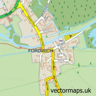
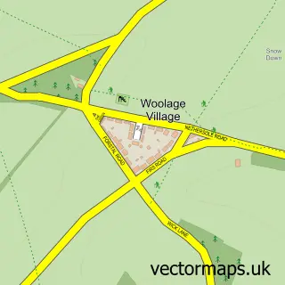
This Kingston street map is a detailed vector street map covering a 750m x 750m area. Select a larger area to create and download your own vector street map of Kingston.
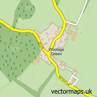
The 750-metre map sample for Kingston covers 125 mapped buildings and approximately 12.5 km of road detail, of which 8 named roads are named. The immediate area includes 1 pub and 3 MOT stations within 2 miles. The wider area around Kingston features 1 food and drink venue. To create a larger or custom map of Kingston, the map builder lets you define your own coverage area and download editable SVG, PDF and PNG files.
Create a larger editable map of Kingston
Choose any area you need and generate a high-quality vector map instantly. Perfect for print, planning, design, business and personal use.

This Kingston street map in Kent is available as downloadable SVG, PDF and PNG map files, or as a printed map for planning, business, display, education, local information and design work. You can also create a larger custom map area using the map selector.
What this Kingston map sample shows
Kingston lies within Kingston Cp parish, part of Nailbourne ward in the Canterbury District (B) local authority area. The postcode geography for this area includes the CT postcode area, the CT4 postcode district and the CT4 6 postcode sector. Residents fall under the Nhs Kent And Medway Integrated Care Board for NHS services.
Local features near Kingston
Within 2 milesAmenities and services in and around Kingston.
Administrative and postcode information for Kingston
The local authority covering Kingston is Canterbury District (B), within the county of Kent. The settlement lies within Nailbourne ward and Kingston Cp civil parish. The CT4 postcode district and CT4 6 postcode sector serve the immediate area. NHS provision in the area is delivered through East Kent Hospitals University Nhs Foundation Trust.
Nearby street map samples around Kingston

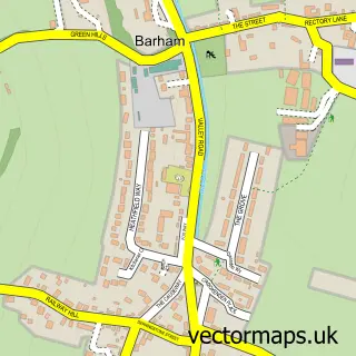
More street maps in Kent
750 metre map area coverage
Boundary, postcode and point of interest information for the 750m x 750m rectangle centred on this sample map.
Boundaries containing map centre
Constituency: Canterbury Co Const
County: Kent County
District: Canterbury District (B)
Icb: NHS Kent and Medway ICB
Parish: Kingston CP
Police Force: kent
Postcode District: CT4
Postcode Sector: CT4 6
Ward: Nailbourne Ward
Nearby boundaries intersecting sample
Parish: Barham CP
Postcode coverage
POI category counts
Anglican Church: 1
Assisted Living Facility: 1
Baptist Church: 1
Bridal Shop: 1
Driving School: 1
Event Planning: 1
Home Service: 1
Printing Services: 1
Pub: 1
Telecommunications: 1
Sample points of interest
- St Giles
- Kingston House
- St John's church, Barham
- Arterworks
- Kingston Driving School
- Kingston Barn
- Explorers Childminding Kent
- The Barn at Kingston
- The Black Robin
- Alexander Digital Aerials and Satellite
Create a larger editable map of Kingston
This sample shows only a 750 metre area. To create a larger map of Kingston, use our map builder to choose your own coverage area, add titles and download editable SVG, PDF and PNG files.
Create a custom map of Kingston