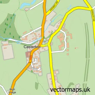
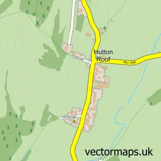
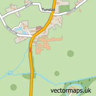
This Kirkby Lonsdale street map is a detailed vector street map covering a 750m x 750m area. Select a larger area to create and download your own vector street map of Kirkby Lonsdale.
The 750-metre map sample for Kirkby Lonsdale covers 293 mapped buildings and approximately 13.1 km of road detail, of which 34 named roads are named. The immediate area includes 1 GP surgery, 4 pubs and 3 MOT stations within 2 miles. The wider area around Kirkby Lonsdale features 2 tourism points of interest, 13 food and drink venues and 9 hotels. To create a larger or custom map of Kirkby Lonsdale, the map builder lets you define your own coverage area and download editable SVG, PDF and PNG files.
Create a larger editable map of Kirkby Lonsdale
Choose any area you need and generate a high-quality vector map instantly. Perfect for print, planning, design, business and personal use.

This Kirkby Lonsdale street map in Cumbria is available as downloadable SVG, PDF and PNG map files, or as a printed map for planning, business, display, education, local information and design work. You can also create a larger custom map area using the map selector.
What this Kirkby Lonsdale map sample shows
Kirkby Lonsdale lies within Kirkby Lonsdale Cp parish, part of Sedbergh & Kirkby Lonsdale ward in the Westmorland And Furness local authority area. The postcode geography for this area includes the LA postcode area, the LA6 postcode district and the LA6 2 postcode sector. Residents fall under the Nhs Lancashire And South Cumbria Integrated Care Board for NHS services.
Local features near Kirkby Lonsdale
Within 2 milesAmenities and services in and around Kirkby Lonsdale.
Administrative and postcode information for Kirkby Lonsdale
The local authority covering Kirkby Lonsdale is Westmorland And Furness, within the county of Cumbria. The settlement lies within Sedbergh & Kirkby Lonsdale ward and Kirkby Lonsdale Cp civil parish. The LA6 postcode district and LA6 2 postcode sector serve the immediate area. NHS provision in the area is delivered through University Hospitals Of Morecambe Bay Nhs Foundation Trust.
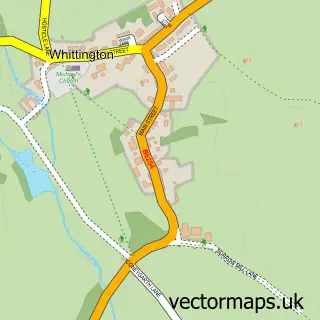
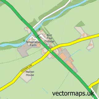
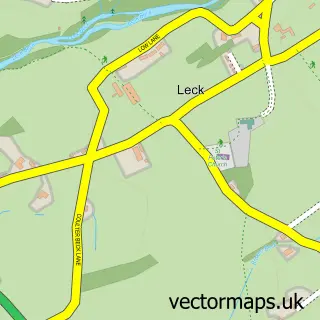
Nearby street map samples around Kirkby Lonsdale

More street maps in Cumbria
750 metre map area coverage
Boundary, postcode and point of interest information for the 750m x 750m rectangle centred on this sample map.
Boundaries containing map centre
Constituency: Morecambe and Lunesdale Co Const
District: Westmorland and Furness
Icb: NHS Lancashire and South Cumbria ICB
Parish: Kirkby Lonsdale CP
Police Force: cumbria
Postcode District: LA6
Postcode Sector: LA6 2
Ward: Sedbergh and Kirkby Lonsdale Ward
Nearby boundaries intersecting sample
Parish: Casterton CP
Postcode coverage
POI category counts
Hotel: 9
Flowers And Gifts Shop: 8
Gift Shop: 5
Cafe: 4
Clothing Store: 4
Doctor: 4
Home Cleaning: 4
Pub: 4
Beauty Salon: 3
Business Management Services: 3
Sample points of interest
- Belle Vue Stables - Training and Livery yard
- Bancroft Antique Dealers
- Herdwick House
- The Bath House
- Finestra Gallery
- The Loovre
- Finestra Gallery
- The Craft Cottage
- James Thompson
- The Hearing Centre Kirkby Lonsdale
- Pintail Boats
- InstaVolt Charging Station
Create a larger editable map of Kirkby Lonsdale
This sample shows only a 750 metre area. To create a larger map of Kirkby Lonsdale, use our map builder to choose your own coverage area, add titles and download editable SVG, PDF and PNG files.
Create a custom map of Kirkby Lonsdale