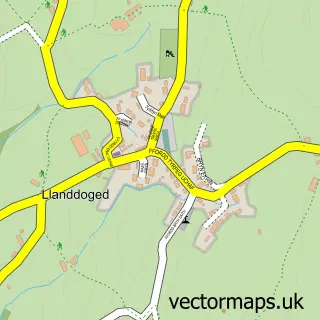
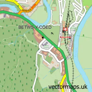
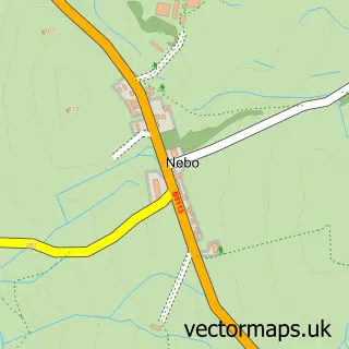
This Llanrwst street map is a detailed vector street map covering a 750m x 750m area. Select a larger area to create and download your own vector street map of Llanrwst.
The 750-metre map sample for Llanrwst covers 287 mapped buildings and approximately 14.9 km of road detail, of which 23 named roads are named. The immediate area includes 1 railway station, 3 pubs and 2 MOT stations within 2 miles. The wider area around Llanrwst features 9 food and drink venues and 1 campsite within 2 miles. To create a larger or custom map of Llanrwst, the map builder lets you define your own coverage area and download editable SVG, PDF and PNG files.
Create a larger editable map of Llanrwst
Choose any area you need and generate a high-quality vector map instantly. Perfect for print, planning, design, business and personal use.

This Llanrwst street map in Clwyd is available as downloadable SVG, PDF and PNG map files, or as a printed map for planning, business, display, education, local information and design work. You can also create a larger custom map area using the map selector.
What this Llanrwst map sample shows
Llanrwst lies within Llanrwst Community parish, part of Crwst ward in the Conwy - Conwy local authority area. The postcode geography for this area includes the LL postcode area, the LL26 postcode district and the LL26 0 postcode sector. Residents fall under the Betsi Cadwaladr University Health Board for NHS services.
Local features near Llanrwst
Within 2 milesAmenities and services in and around Llanrwst.
Administrative and postcode information for Llanrwst
The local authority covering Llanrwst is Conwy - Conwy, within the county of Clwyd. The settlement lies within Crwst ward and Llanrwst Community civil parish. The LL26 postcode district and LL26 0 postcode sector serve the immediate area. NHS provision in the area is delivered through Betsi Cadwaladr University Health Board.
Nearby street map samples around Llanrwst

More street maps in Clwyd
750 metre map area coverage
Boundary, postcode and point of interest information for the 750m x 750m rectangle centred on this sample map.
Boundaries containing map centre
Constituency: Bangor Aberconwy Co Const
District: Conwy - Conwy
Icb: Betsi Cadwaladr University
Parish: Llanrwst Community
Police Force: north wales
Postcode District: LL26
Postcode Sector: LL26 0
Nearby boundaries intersecting sample
No additional intersecting boundaries found.
Postcode coverage
POI category counts
Beauty Salon: 5
Cafe: 4
Convenience Store: 4
Professional Services: 4
Atms: 3
Butcher Shop: 3
Community Services Non Profits: 3
Flowers And Gifts Shop: 3
Hair Salon: 3
Property Management: 3
Sample points of interest
- Snowdonia Antiques
- Tilt and Shift
- The Crafty Kitten
- Pageant Wood Crafts
- Ty Abbeyfield
- Barclays ATM
- PayPoint
- The Cooperative Food (BF) Llanrwst, Conwy
- Geraint Davies Hearing
- Willz Detailing
- Scilicorns Bakery
- Shepherd's Biscuits
Create a larger editable map of Llanrwst
This sample shows only a 750 metre area. To create a larger map of Llanrwst, use our map builder to choose your own coverage area, add titles and download editable SVG, PDF and PNG files.
Create a custom map of Llanrwst