Vector Maps logo
Home Why it works Popular maps Districts Samples Customizer Create Your Map
VectorMaps.uk
Home Popular maps Districts Samples Customizer Create Your Map Privacy Disclaimer
Home / UK Maps / Ayrshire and Arran / Lochranza Map

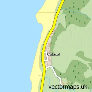
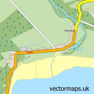
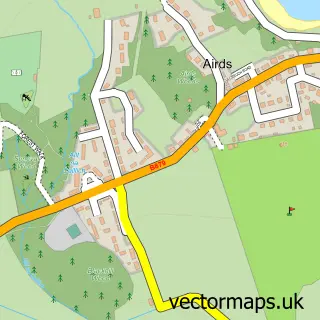
This Lochranza street map is a detailed vector street map covering a 750m x 750m area. Select a larger area to create and download your own vector street map of Lochranza.

Lochranza is a village in Ayrshire And Arran.

The 750-metre map sample for Lochranza covers 50 mapped buildings and approximately 4.0 km of road detail. The wider area around Lochranza features 1 tourism point of interest, 4 hotels and 1 campsite within 2 miles. To create a larger or custom map of Lochranza, the map builder lets you define your own coverage area and download editable SVG, PDF and PNG files.

50Buildings
3.98 kmRoads
0Named roads
0Residents within 2 miles
Create your own

Create a larger editable map of Lochranza

Choose any area you need and generate a high-quality vector map instantly. Perfect for print, planning, design, business and personal use.

Choose any location
Editable SVG files
Any size up to A0
PDF, PNG & more
Instant download
High quality guaranteed
Create My Custom Map
Secure, private & no credit card required
Lochranza Vector Street Map
750m Sample
Lochranza vector street map sample showing roads, buildings and local features in a 750 metre preview area
Buy Lochranza Map Print from £12.95 Buy Lochranza Digital Map from £6

This Lochranza street map in Ayrshire and Arran is available as downloadable SVG, PDF and PNG map files, or as a printed map for planning, business, display, education, local information and design work. You can also create a larger custom map area using the map selector.

What this Lochranza map sample shows

Lochranza is a village in Ayrshire And Arran, recorded in the UK street map gallery with associated local administrative and mapping data.

Local features near Lochranza

Within 2 miles

Amenities and services in and around Lochranza.

1 Campsites within 2 miles
1 Tourism & leisure
4 Hotels

Counts are approximate and based on publicly available data.

Administrative and postcode information for Lochranza

Lochranza is a village in Ayrshire And Arran, recorded in the UK street map gallery with associated local administrative and mapping data.

County Ayrshire and Arran

Nearby street map samples around Lochranza

Street map sample of Rothesay, Argyll and Bute Rothesay Town - Argyll and Bute - 13.2 miles Street map sample of Glasgow, City of Glasgow Glasgow City - City of Glasgow - 42.0 miles Street map sample of Millhill, Ayrshire and Arran Millhill Village - Ayrshire and Arran - 0.7 miles Street map sample of Narachan, Ayrshire and Arran Narachan Village - Ayrshire and Arran - 0.9 miles Street map sample of Catacol, Ayrshire and Arran Catacol Village - Ayrshire and Arran - 1.3 miles Street map sample of Skipness, Argyll and Bute Skipness Village - Argyll and Bute - 4.8 miles Street map sample of Sannox, Ayrshire and Arran Sannox Village - Ayrshire and Arran - 6.4 miles Street map sample of Corrie, Ayrshire and Arran Corrie Village - Ayrshire and Arran - 7.3 miles Street map sample of Brodick, Ayrshire and Arran Brodick Village - Ayrshire and Arran - 10.4 miles Street map sample of Carradale, Argyll and Bute Carradale Village - Argyll and Bute - 10.5 miles

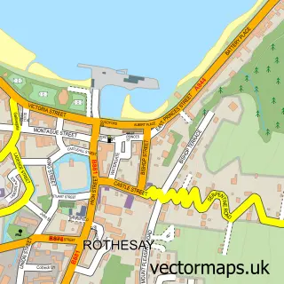
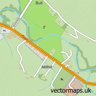
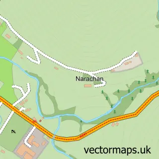
More street maps in Ayrshire and Arran

Street map sample of Millhill, Ayrshire and Arran Millhill Village - 0.7 miles Street map sample of Narachan, Ayrshire and Arran Narachan Village - 0.9 miles Street map sample of Catacol, Ayrshire and Arran Catacol Village - 1.3 miles Street map sample of Sannox, Ayrshire and Arran Sannox Village - 6.4 miles Street map sample of Corrie, Ayrshire and Arran Corrie Village - 7.3 miles

750 metre map area coverage

Boundary, postcode and point of interest information for the 750m x 750m rectangle centred on this sample map.

Boundaries containing map centre

Constituency: North Ayrshire and Arran Co Const

District: North Ayrshire

Icb: Ayrshire and Arran

Postcode District: KA27

Postcode Sector: KA27 8

Ward: Arran Ward

Nearby boundaries intersecting sample

No additional intersecting boundaries found.

Postcode coverage

KA27 KA27 8

POI category counts

Hotel: 4

Castle: 1

Hostel: 1

Inn: 1

Sample points of interest

  • Lochranza Castle Castle
  • SYHA - Lochranza Hostel
  • Castlekirk Arthouse Hotel
  • Lochranza Caravan & Camp Site Hotel
  • Lochranza Hotel Hotel
  • Lochranza Hotel Country Inn Hotel
  • Lochranza Country Inn Inn

Create a larger editable map of Lochranza

This sample shows only a 750 metre area. To create a larger map of Lochranza, use our map builder to choose your own coverage area, add titles and download editable SVG, PDF and PNG files.

Create a custom map of Lochranza

Phone 01751 473136 | Copyright Vectormaps.uk 2026

Samples Customizer Privacy Disclaimer
Lochranza Vector Street Map
Lochranza enlarged street map sample showing a 750 metre preview area