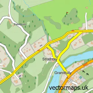
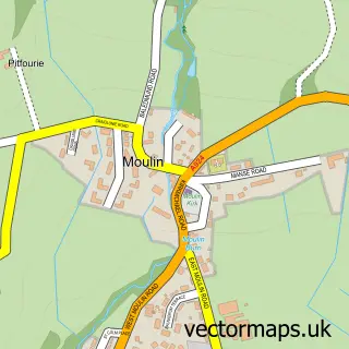
This Logierait street map is a detailed vector street map covering a 750m x 750m area. Select a larger area to create and download your own vector street map of Logierait.
The 750-metre map sample for Logierait covers 21 mapped buildings and approximately 18.1 km of road detail, of which 2 named roads are named. The wider area around Logierait features 1 food and drink venue and 1 hotel. To create a larger or custom map of Logierait, the map builder lets you define your own coverage area and download editable SVG, PDF and PNG files.
Create a larger editable map of Logierait
Choose any area you need and generate a high-quality vector map instantly. Perfect for print, planning, design, business and personal use.

This Logierait street map in Perth and Kinross is available as downloadable SVG, PDF and PNG map files, or as a printed map for planning, business, display, education, local information and design work. You can also create a larger custom map area using the map selector.
What this Logierait map sample shows
Logierait lies within Perth And Kinross parish, part of Highland ward in the Perth And Kinross local authority area. The postcode geography for this area includes the PH postcode area, the PH9 postcode district and the PH9 0 postcode sector. Residents fall under the Tayside for NHS services.
Local features near Logierait
Within 2 milesAmenities and services in and around Logierait.
Administrative and postcode information for Logierait
Logierait lies within Perth And Kinross parish, part of Highland ward in the Perth And Kinross local authority area. The postcode geography for this area includes the PH postcode area, the PH9 postcode district and the PH9 0 postcode sector. Residents fall under the Tayside for NHS services.
Nearby street map samples around Logierait

More street maps in Perth and Kinross
750 metre map area coverage
Boundary, postcode and point of interest information for the 750m x 750m rectangle centred on this sample map.
Boundaries containing map centre
Constituency: Angus and Perthshire Glens Co Const
District: Perth and Kinross
Icb: Tayside
Postcode District: PH9
Postcode Sector: PH9 0
Ward: Highland Ward
Nearby boundaries intersecting sample
Ward: Strathtay Ward
Postcode coverage
POI category counts
Bar: 1
Bed And Breakfast: 1
Catholic Church: 1
Church Cathedral: 1
Coffee Shop: 1
Cottage: 1
Hotel: 1
Inn: 1
Sample points of interest
- Logierait Inn
- Cuil An Daraich Guest House
- Grantully,logierait and Strathtay
- Grandtully, Logierait and Strathtay Church
- 1717 Coffee Shop
- Tay Bunkhouse
- Logierait Pine Lodges
- The Logierait Inn
Create a larger editable map of Logierait
This sample shows only a 750 metre area. To create a larger map of Logierait, use our map builder to choose your own coverage area, add titles and download editable SVG, PDF and PNG files.
Create a custom map of Logierait