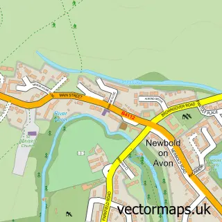
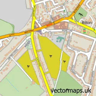
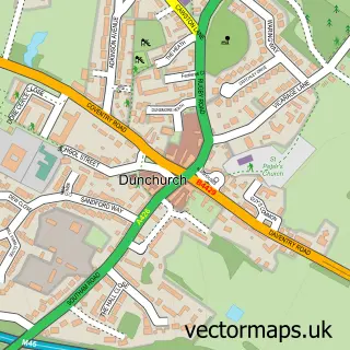
This Long Lawford street map is a detailed vector street map covering a 750m x 750m area. Select a larger area to create and download your own vector street map of Long Lawford.
The 750-metre map sample for Long Lawford covers 411 mapped buildings and approximately 30.8 km of road detail, of which 32 named roads are named. The immediate area includes 1 school, 3 GP surgeries within 2 miles, 2 pubs and 12 MOT stations within 2 miles. The wider area around Long Lawford features 2 tourism points of interest and 3 food and drink venues. To create a larger or custom map of Long Lawford, the map builder lets you define your own coverage area and download editable SVG, PDF and PNG files.
Create a larger editable map of Long Lawford
Choose any area you need and generate a high-quality vector map instantly. Perfect for print, planning, design, business and personal use.

This Long Lawford street map in Warwickshire is available as downloadable SVG, PDF and PNG map files, or as a printed map for planning, business, display, education, local information and design work. You can also create a larger custom map area using the map selector.
What this Long Lawford map sample shows
Long Lawford lies within Long Lawford Cp parish, part of Wolston And The Lawfords ward in the Rugby District (B) local authority area. The postcode geography for this area includes the CV postcode area, the CV23 postcode district and the CV23 9 postcode sector. Residents fall under the Nhs Coventry And Warwickshire Integrated Care Board for NHS services.
Local features near Long Lawford
Within 2 milesAmenities and services in and around Long Lawford.
Administrative and postcode information for Long Lawford
The local authority covering Long Lawford is Rugby District (B), within the county of Warwickshire. The settlement lies within Wolston And The Lawfords ward and Long Lawford Cp civil parish. The CV23 postcode district and CV23 9 postcode sector serve the immediate area. NHS provision in the area is delivered through University Hospitals Coventry And Warwickshire Nhs Trust.
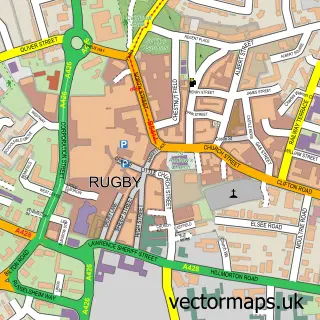
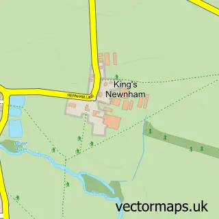
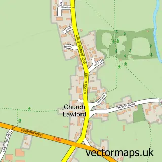
Nearby street map samples around Long Lawford

More street maps in Warwickshire
750 metre map area coverage
Boundary, postcode and point of interest information for the 750m x 750m rectangle centred on this sample map.
Boundaries containing map centre
Constituency: Rugby Co Const
County: Warwickshire County
District: Rugby District (B)
Icb: NHS Coventry and Warwickshire ICB
Parish: Long Lawford CP
Police Force: warwickshire
Postcode District: CV23
Postcode Sector: CV23 9
Ward: Wolston and the Lawfords Ward
Nearby boundaries intersecting sample
Parish: Little Lawford CP
Postcode coverage
POI category counts
Hair Salon: 3
Beauty And Spa: 2
Building Supply Store: 2
Church Cathedral: 2
Contractor: 2
Convenience Store: 2
Elementary School: 2
Grocery Store: 2
Landscaping: 2
Package Locker: 2
Sample points of interest
- Instafollowers
- St John
- Louise’s beauty
- Pink Chocolate Salon
- Heart of England Hair & Beauty Academy
- Spencer & Co
- Stellar Electrical Contracting
- TRS Hot Fried Chicken
- Cornerstone Community Church
- Long Lawford Methodist Church
- Costa Express
- Memorial Hall Long Lawford
Create a larger editable map of Long Lawford
This sample shows only a 750 metre area. To create a larger map of Long Lawford, use our map builder to choose your own coverage area, add titles and download editable SVG, PDF and PNG files.
Create a custom map of Long Lawford