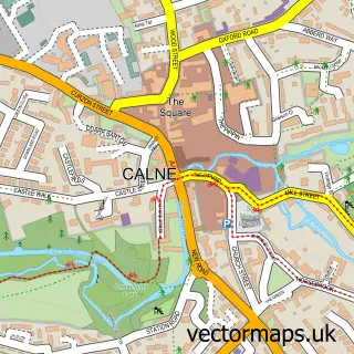
This Lower Compton street map is a detailed vector street map covering a 750m x 750m area. Select a larger area to create and download your own vector street map of Lower Compton.
The 750-metre map sample for Lower Compton covers 100 mapped buildings and approximately 6.8 km of road detail, of which 11 named roads are named. The immediate area includes 2 GP surgeries within 2 miles and 5 MOT stations within 2 miles. The wider area around Lower Compton features 1 tourism point of interest and 1 campsite within 2 miles. To create a larger or custom map of Lower Compton, the map builder lets you define your own coverage area and download editable SVG, PDF and PNG files.
Create a larger editable map of Lower Compton
Choose any area you need and generate a high-quality vector map instantly. Perfect for print, planning, design, business and personal use.

This Lower Compton street map in Wiltshire is available as downloadable SVG, PDF and PNG map files, or as a printed map for planning, business, display, education, local information and design work. You can also create a larger custom map area using the map selector.
What this Lower Compton map sample shows
Lower Compton lies within Calne Without Cp parish, part of Calne Rural ward in the Wiltshire local authority area. The postcode geography for this area includes the SN postcode area, the SN11 postcode district and the SN11 8 postcode sector. Residents fall under the Nhs Bath And North East Somerset, Swindon And Wiltshire Integrated Care Board for NHS services.
Local features near Lower Compton
Within 2 milesAmenities and services in and around Lower Compton.
Administrative and postcode information for Lower Compton
The local authority covering Lower Compton is Wiltshire, within the county of Wiltshire. The settlement lies within Calne Rural ward and Calne Without Cp civil parish. The SN11 postcode district and SN11 8 postcode sector serve the immediate area. NHS provision in the area is delivered through Great Western Hospitals Nhs Foundation Trust.
Nearby street map samples around Lower Compton


More street maps in Wiltshire
750 metre map area coverage
Boundary, postcode and point of interest information for the 750m x 750m rectangle centred on this sample map.
Boundaries containing map centre
Constituency: Chippenham Co Const
District: Wiltshire
Icb: NHS Bath and North East Somerset Swindon and Wiltshire ICB
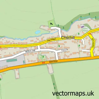
Parish: Cherhill CP
Police Force: wiltshire
Postcode District: SN11
Postcode Sector: SN11 8
Nearby boundaries intersecting sample
No additional intersecting boundaries found.
Postcode coverage
POI category counts
Active Life: 1
Business Management Services: 1
Dog Walkers: 1
Lake: 1
Landmark And Historical Building: 1
Library: 1
Recycling Center: 1
Sample points of interest
- Jay Vee Fitness
- Marshall Assist
- All Weather Walkies and Pet Care
- Sabre Lake Fishing
- Lower Compton Doorless Phone Box
- Little Buddies Little Free Library
- Honeyball Household Recycling Centre
Create a larger editable map of Lower Compton
This sample shows only a 750 metre area. To create a larger map of Lower Compton, use our map builder to choose your own coverage area, add titles and download editable SVG, PDF and PNG files.
Create a custom map of Lower Compton