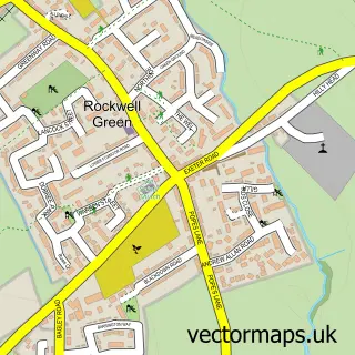
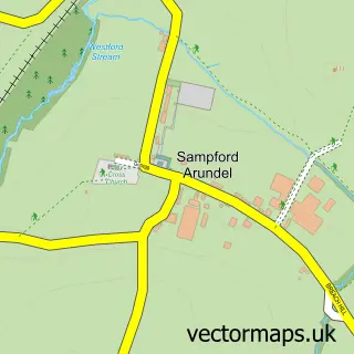
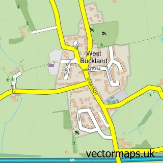
This Lower Westford street map is a detailed vector street map covering a 750m x 750m area. Select a larger area to create and download your own vector street map of Lower Westford.
The 750-metre map sample for Lower Westford covers 271 mapped buildings and approximately 10.7 km of road detail, of which 19 named roads are named. The immediate area includes 1 school, 1 GP surgery within 2 miles and 7 MOT stations within 2 miles. The wider area around Lower Westford features 2 tourism points of interest and 1 campsite within 2 miles. To create a larger or custom map of Lower Westford, the map builder lets you define your own coverage area and download editable SVG, PDF and PNG files.
Create a larger editable map of Lower Westford
Choose any area you need and generate a high-quality vector map instantly. Perfect for print, planning, design, business and personal use.

This Lower Westford street map in Somerset is available as downloadable SVG, PDF and PNG map files, or as a printed map for planning, business, display, education, local information and design work. You can also create a larger custom map area using the map selector.
What this Lower Westford map sample shows
Lower Westford lies within Wellington Cp parish, part of Rockwell Green ward in the Somerset local authority area. The postcode geography for this area includes the TA postcode area, the TA21 postcode district and the TA21 9 postcode sector. Residents fall under the Nhs Somerset Integrated Care Board for NHS services.
Local features near Lower Westford
Within 2 milesAmenities and services in and around Lower Westford.
Administrative and postcode information for Lower Westford
Lower Westford lies within Wellington Cp parish, part of Rockwell Green ward in the Somerset local authority area. The postcode geography for this area includes the TA postcode area, the TA21 postcode district and the TA21 9 postcode sector. Residents fall under the Nhs Somerset Integrated Care Board for NHS services.
Nearby street map samples around Lower Westford

More street maps in Somerset
750 metre map area coverage
Boundary, postcode and point of interest information for the 750m x 750m rectangle centred on this sample map.
Boundaries containing map centre
Constituency: Taunton and Wellington Co Const
District: Somerset
Icb: NHS Somerset ICB
Parish: Wellington CP
Police Force: avon and somerset
Postcode District: TA21
Postcode Sector: TA21 0
Nearby boundaries intersecting sample
Postcode Sector: TA21 8, TA21 9
Postcode coverage
POI category counts
Landmark And Historical Building: 2
Bakery: 1
Bar: 1
Beauty Salon: 1
Building Supply Store: 1
Butcher Shop: 1
Church Cathedral: 1
Contractor: 1
Elementary School: 1
Financial Advising: 1
Sample points of interest
- Nynehead Bakehouse
- Weavers Arms
- Michelle Hall at The Hair Room.
- Cookaburra Oven Clean Services
- M J Coate
- The Well Christian Centre
- TLR kitchens
- Rockwell Green Church of England Primary School
- Generation Wealth
- Absolute Flooring Solutions
- Foxmoor Upholstery
- Jeffrey M Williams
Create a larger editable map of Lower Westford
This sample shows only a 750 metre area. To create a larger map of Lower Westford, use our map builder to choose your own coverage area, add titles and download editable SVG, PDF and PNG files.
Create a custom map of Lower Westford