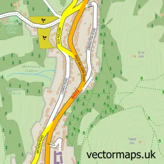
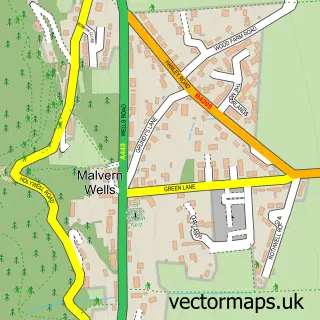
This Malvern street map is a detailed vector street map covering a 750m x 750m area. Select a larger area to create and download your own vector street map of Malvern.
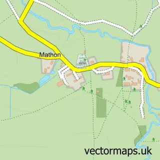
The 750-metre map sample for Malvern covers 373 mapped buildings and approximately 50.6 km of road detail, of which 25 named roads are named. The immediate area includes 4 GP surgeries within 2 miles and 11 MOT stations within 2 miles. The wider area around Malvern features 1 tourism point of interest, 2 food and drink venues and 4 hotels. To create a larger or custom map of Malvern, the map builder lets you define your own coverage area and download editable SVG, PDF and PNG files.
Create a larger editable map of Malvern
Choose any area you need and generate a high-quality vector map instantly. Perfect for print, planning, design, business and personal use.

This Malvern street map in Worcestershire is available as downloadable SVG, PDF and PNG map files, or as a printed map for planning, business, display, education, local information and design work. You can also create a larger custom map area using the map selector.
What this Malvern map sample shows
Malvern lies within Malvern Cp parish, part of Priory ward in the Malvern Hills District local authority area. The postcode geography for this area includes the WR postcode area, the WR14 postcode district and the WR14 4 postcode sector. Residents fall under the Nhs Herefordshire And Worcestershire Integrated Care Board for NHS services.
Local features near Malvern
Within 2 milesAmenities and services in and around Malvern.
Administrative and postcode information for Malvern
Malvern lies within Malvern Cp parish, part of Priory ward in the Malvern Hills District local authority area. The postcode geography for this area includes the WR postcode area, the WR14 postcode district and the WR14 4 postcode sector. Residents fall under the Nhs Herefordshire And Worcestershire Integrated Care Board for NHS services.
Nearby street map samples around Malvern

More street maps in Worcestershire
750 metre map area coverage
Boundary, postcode and point of interest information for the 750m x 750m rectangle centred on this sample map.
Boundaries containing map centre
Constituency: West Worcestershire Co Const
County: Worcestershire County
District: Malvern Hills District
Icb: NHS Herefordshire and Worcestershire ICB
Parish: Malvern CP
Police Force: west mercia
Postcode District: WR14
Postcode Sector: WR14 2
Ward: Great Malvern Ward
Nearby boundaries intersecting sample
Postcode Sector: WR14 1, WR14 4
Ward: Link Ward, West Ward
Postcode coverage
POI category counts
Hotel: 4
Naturopathic Holistic: 4
Real Estate Agent: 4
Sports Club And League: 4
Community Services Non Profits: 3
Podiatrist: 3
Accountant: 2
Airport Shuttles: 2
Alternative Medicine: 2
Antique Store: 2
Sample points of interest
- Elizabeth Eyre Limited
- Kendall Wadley
- Alison Moon Acupuncture
- MET - Malvern Taxis & Airport Transfers
- MET Cars
- Centre For Wellbeing
- The Lighter Touch
- Foley House Antiques
- Richmond house antiques - malvern
- Gas Appliance Showroom
- Matthew Gullick Architects
- Riding High
Create a larger editable map of Malvern
This sample shows only a 750 metre area. To create a larger map of Malvern, use our map builder to choose your own coverage area, add titles and download editable SVG, PDF and PNG files.
Create a custom map of Malvern