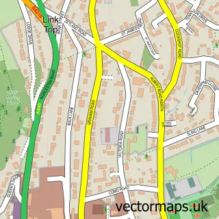
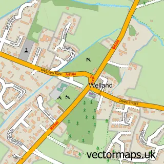
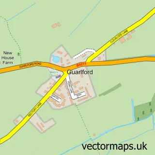
This Malvern Wells street map is a detailed vector street map covering a 750m x 750m area. Select a larger area to create and download your own vector street map of Malvern Wells.
The 750-metre map sample for Malvern Wells covers 243 mapped buildings and approximately 36.7 km of road detail, of which 10 named roads are named. The immediate area includes 1 GP surgery within 2 miles and 3 MOT stations within 2 miles. The wider area around Malvern Wells features 1 tourism point of interest, 1 food and drink venue and 2 hotels. To create a larger or custom map of Malvern Wells, the map builder lets you define your own coverage area and download editable SVG, PDF and PNG files.
Create a larger editable map of Malvern Wells
Choose any area you need and generate a high-quality vector map instantly. Perfect for print, planning, design, business and personal use.

This Malvern Wells street map in Worcestershire is available as downloadable SVG, PDF and PNG map files, or as a printed map for planning, business, display, education, local information and design work. You can also create a larger custom map area using the map selector.
What this Malvern Wells map sample shows
Malvern Wells lies within Malvern Wells Cp parish, part of Wells ward in the Malvern Hills District local authority area. The postcode geography for this area includes the WR postcode area, the WR14 postcode district and the WR14 4 postcode sector. Residents fall under the Nhs Herefordshire And Worcestershire Integrated Care Board for NHS services.
Local features near Malvern Wells
Within 2 milesAmenities and services in and around Malvern Wells.
Administrative and postcode information for Malvern Wells
Malvern Wells lies within Malvern Wells Cp parish, part of Wells ward in the Malvern Hills District local authority area. The postcode geography for this area includes the WR postcode area, the WR14 postcode district and the WR14 4 postcode sector. Residents fall under the Nhs Herefordshire And Worcestershire Integrated Care Board for NHS services.
Nearby street map samples around Malvern Wells

More street maps in Worcestershire
750 metre map area coverage
Boundary, postcode and point of interest information for the 750m x 750m rectangle centred on this sample map.
Boundaries containing map centre
Constituency: West Worcestershire Co Const
County: Worcestershire County
District: Malvern Hills District
Icb: NHS Herefordshire and Worcestershire ICB
Parish: Malvern Wells CP
Police Force: west mercia
Postcode District: WR14
Postcode Sector: WR14 4
Ward: Castlemorton, Welland & Wells Ward
Nearby boundaries intersecting sample
No additional intersecting boundaries found.
Postcode coverage
POI category counts
Bed And Breakfast: 3
Advertising Agency: 2
Car Dealer: 2
Hair Salon: 2
Hotel: 2
Music School: 2
Thai Restaurant: 2
Beauty Salon: 1
Building Supply Store: 1
Business Management Services: 1
Sample points of interest
- Jupiter Jasper Communication Design
- TCM Design
- The Malvern Well
- The Brambles
- The Dell House
- The Old Coach House
- Two Sisters Garden Services
- Egourmet Ltd.
- Rotaire Dryline
- A D Daniels
- Daniels Petroleum Ltd
- Maulvern Hills Nct
Create a larger editable map of Malvern Wells
This sample shows only a 750 metre area. To create a larger map of Malvern Wells, use our map builder to choose your own coverage area, add titles and download editable SVG, PDF and PNG files.
Create a custom map of Malvern Wells