Vector Maps logo
Home Why it works Popular maps Districts Samples Customizer Create Your Map
VectorMaps.uk
Home Popular maps Districts Samples Customizer Create Your Map Privacy Disclaimer
Home / UK Maps / Fife / Newburgh Map

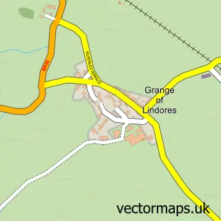
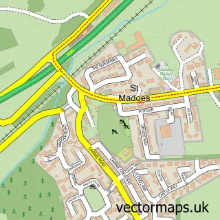
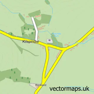
This Newburgh street map is a detailed vector street map covering a 750m x 750m area. Select a larger area to create and download your own vector street map of Newburgh.

Newburgh is a town in Fife, in the Mid Scotland And Fife of Scotland. The settlement falls within the North East Fife parliamentary constituency. It is served by the KY14 postcode district, with KY14 6 as the local postcode sector.

The 750-metre map sample for Newburgh covers 176 mapped buildings and approximately 14.2 km of road detail, of which 24 named roads are named. The immediate area includes 1 GP surgery, 1 pub and 1 MOT station. The wider area around Newburgh features 2 tourism points of interest, 5 food and drink venues and 2 hotels. To create a larger or custom map of Newburgh, the map builder lets you define your own coverage area and download editable SVG, PDF and PNG files.

176Buildings
14.23 kmRoads
24Named roads
0Residents within 2 miles
Create your own

Create a larger editable map of Newburgh

Choose any area you need and generate a high-quality vector map instantly. Perfect for print, planning, design, business and personal use.

Choose any location
Editable SVG files
Any size up to A0
PDF, PNG & more
Instant download
High quality guaranteed
Create My Custom Map
Secure, private & no credit card required
Newburgh Vector Street Map
750m Sample
Newburgh vector street map sample showing roads, buildings and local features in a 750 metre preview area
Buy Newburgh Map Print from £12.95 Buy Newburgh Digital Map from £6

This Newburgh street map in Fife is available as downloadable SVG, PDF and PNG map files, or as a printed map for planning, business, display, education, local information and design work. You can also create a larger custom map area using the map selector.

What this Newburgh map sample shows

Newburgh lies within Fife parish, part of Howe Of Fife And Tay Coast ward in the Fife local authority area. The postcode geography for this area includes the KY postcode area, the KY14 postcode district and the KY14 6 postcode sector. Residents fall under the Fife for NHS services.

Local features near Newburgh

Within 2 miles

Amenities and services in and around Newburgh.

1 GP surgeries 1 within 2 miles
1 MOT stations 1 within 2 miles
2 Tourism & leisure
5 Food & drink
1 Pubs
2 Hotels
2 Healthcare POIs
1 Vehicle services

Counts are approximate and based on publicly available data.

Administrative and postcode information for Newburgh

Newburgh lies within Fife parish, part of Howe Of Fife And Tay Coast ward in the Fife local authority area. The postcode geography for this area includes the KY postcode area, the KY14 postcode district and the KY14 6 postcode sector. Residents fall under the Fife for NHS services.

Parish FIFE
Ward Howe of Fife and Tay Coast
District / local authority Fife
County Fife
Historic county Fife
Postcode district KY14
Postcode sector KY14 6
Parliamentary constituency North East Fife
Region Mid Scotland and Fife
Country Scotland

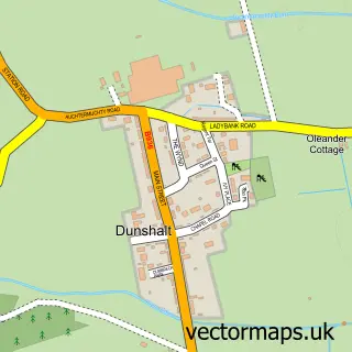
Nearby street map samples around Newburgh

Street map sample of Perth, Perth and Kinross Perth City - Perth and Kinross - 8.0 miles Street map sample of Grange of Lindores, Fife Grange of Lindores Village - Fife - 1.5 miles Street map sample of Lindores, Fife Lindores Village - Fife - 2.0 miles Street map sample of Cottown, Perth and Kinross Cottown Village - Perth and Kinross - 2.5 miles Street map sample of Errol, Perth and Kinross Errol Village - Perth and Kinross - 2.9 miles Street map sample of St Madoes, Perth and Kinross St Madoes Village - Perth and Kinross - 3.1 miles Street map sample of Abernethy, Perth and Kinross Abernethy Village - Perth and Kinross - 3.1 miles Street map sample of Glencarse, Perth and Kinross Glencarse Village - Perth and Kinross - 3.2 miles Street map sample of Collessie, Fife Collessie Village - Fife - 4.4 miles Street map sample of Kilspindie, Perth and Kinross Kilspindie Village - Perth and Kinross - 4.7 miles

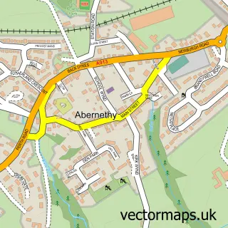
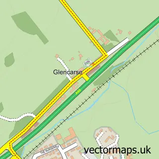
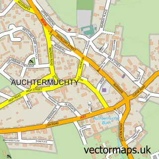
More street maps in Fife

Street map sample of Grange of Lindores, Fife Grange of Lindores Village - 1.5 miles Street map sample of Lindores, Fife Lindores Village - 2.0 miles Street map sample of Auchtermuchty, Fife Auchtermuchty Town - 4.1 miles Street map sample of Collessie, Fife Collessie Village - 4.4 miles Street map sample of Dunshalt, Fife Dunshalt Village - 4.9 miles

750 metre map area coverage

Boundary, postcode and point of interest information for the 750m x 750m rectangle centred on this sample map.

Boundaries containing map centre

Constituency: North East Fife Co Const

District: Fife

Icb: Fife

Postcode District: KY14

Postcode Sector: KY14 6

Ward: Howe of Fife and Tay Coast Ward

Nearby boundaries intersecting sample

No additional intersecting boundaries found.

Postcode coverage

KY14 KY14 6

POI category counts

Beauty Salon: 2

Cafe: 2

Community Center: 2

Flowers And Gifts Shop: 2

Grocery Store: 2

Hotel: 2

Sports Club And League: 2

Veterinarian: 2

Advertising Agency: 1

Antique Store: 1

Sample points of interest

  • Jellyhound Advertising Agency
  • Potting Shed Antiques & Vintage Antique Store
  • A.S. Associates Ltd. Architect
  • A.S. Associates Ltd Architectural Designer
  • Sun Gallery Art Gallery
  • Sun Gallery Art Museum
  • Twist Fibre Craft Studio Arts And Crafts
  • The Ship Inn Arts And Entertainment
  • Abbotsford Tayside View Assisted Living Facility
  • The Cooperative Food Newburgh High Street, 76-78 High Street Atms
  • Vibrant Glow Auto Detailing
  • Tower Bakery Bakery

Create a larger editable map of Newburgh

This sample shows only a 750 metre area. To create a larger map of Newburgh, use our map builder to choose your own coverage area, add titles and download editable SVG, PDF and PNG files.

Create a custom map of Newburgh

Phone 01751 473136 | Copyright Vectormaps.uk 2026

Samples Customizer Privacy Disclaimer
Newburgh Vector Street Map
Newburgh enlarged street map sample showing a 750 metre preview area