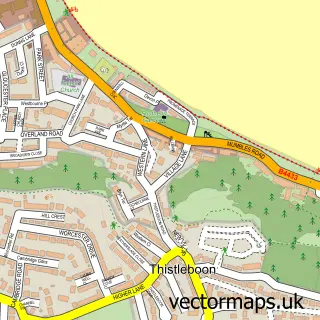
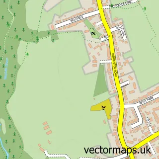
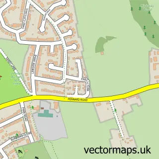
This Newton street map is a detailed vector street map covering a 750m x 750m area. Select a larger area to create and download your own vector street map of Newton.
The 750-metre map sample for Newton covers 538 mapped buildings and approximately 19.1 km of road detail, of which 39 named roads are named. The immediate area includes 1 school, 3 GP surgeries within 2 miles, 1 pub and 1 MOT station, with 2 within 2 miles. The wider area around Newton features 1 tourism point of interest, 1 food and drink venue and 1 hotel. To create a larger or custom map of Newton, the map builder lets you define your own coverage area and download editable SVG, PDF and PNG files.
Create a larger editable map of Newton
Choose any area you need and generate a high-quality vector map instantly. Perfect for print, planning, design, business and personal use.

This Newton street map in West Glamorgan is available as downloadable SVG, PDF and PNG map files, or as a printed map for planning, business, display, education, local information and design work. You can also create a larger custom map area using the map selector.
What this Newton map sample shows
Newton lies within Mumbles Community parish, part of Newton ward in the Abertawe - Swansea local authority area. The postcode geography for this area includes the SA postcode area, the SA3 postcode district and the SA3 4 postcode sector. Local NHS services are provided through Swansea Bay University Health Board.
Local features near Newton
Within 2 milesAmenities and services in and around Newton.
Administrative and postcode information for Newton
The local authority covering Newton is Abertawe - Swansea, within the county of West Glamorgan. The settlement lies within Newton ward and Mumbles Community civil parish. The SA3 postcode district and SA3 4 postcode sector serve the immediate area. NHS provision in the area is delivered through Swansea Bay University Health Board.
Nearby street map samples around Newton

More street maps in West Glamorgan
750 metre map area coverage
Boundary, postcode and point of interest information for the 750m x 750m rectangle centred on this sample map.
Boundaries containing map centre
Constituency: Gower Co Const
District: Abertawe - Swansea
Icb: Abertawe Bro Morgannwg University
Parish: Mumbles Community
Police Force: south wales
Postcode District: SA3
Postcode Sector: SA3 4
Nearby boundaries intersecting sample
Postcode Sector: SA3 5
Postcode coverage
POI category counts
Holiday Rental Home: 2
Accommodation: 1
Anglican Church: 1
Automotive Repair: 1
Beauty Salon: 1
British Restaurant: 1
Building Supply Store: 1
Butcher Shop: 1
Community Center: 1
Contractor: 1
Sample points of interest
- Bryn Parc Holidays
- St. Peter's Church
- Newton Garage
- Beautique Swansea | Swansea
- Bookshop Café Lounge
- RSD Electrical
- Woollacotts Butchers
- Newton Village Hall
- C.E Dendle Builders
- X L Wales
- Newton Primary School
- The Mobile Carpet Showroom
Create a larger editable map of Newton
This sample shows only a 750 metre area. To create a larger map of Newton, use our map builder to choose your own coverage area, add titles and download editable SVG, PDF and PNG files.
Create a custom map of Newton