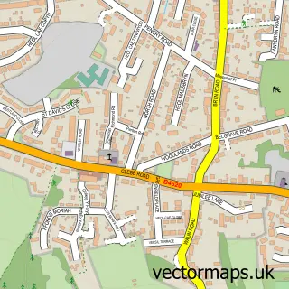
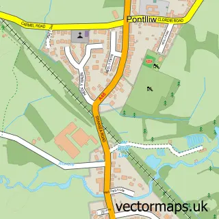
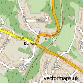
This Gorseinon street map is a detailed vector street map covering a 750m x 750m area. Select a larger area to create and download your own vector street map of Gorseinon.
The 750-metre map sample for Gorseinon covers 509 mapped buildings and approximately 17.7 km of road detail, of which 33 named roads are named. The immediate area includes 1 GP surgery, 3 pubs and 1 MOT station, with 10 within 2 miles. The wider area around Gorseinon features 2 tourism points of interest, 6 food and drink venues and 1 campsite within 2 miles. To create a larger or custom map of Gorseinon, the map builder lets you define your own coverage area and download editable SVG, PDF and PNG files.
Create a larger editable map of Gorseinon
Choose any area you need and generate a high-quality vector map instantly. Perfect for print, planning, design, business and personal use.

This Gorseinon street map in West Glamorgan is available as downloadable SVG, PDF and PNG map files, or as a printed map for planning, business, display, education, local information and design work. You can also create a larger custom map area using the map selector.
What this Gorseinon map sample shows
Gorseinon lies within Gorseinon Community parish, part of Gorseinon ward in the Abertawe - Swansea local authority area. The postcode geography for this area includes the SA postcode area, the SA4 postcode district and the SA4 4 postcode sector. Residents fall under the Swansea Bay University Local Health Board for NHS services.
Local features near Gorseinon
Within 2 milesAmenities and services in and around Gorseinon.
Administrative and postcode information for Gorseinon
Gorseinon lies within Gorseinon Community parish, part of Gorseinon ward in the Abertawe - Swansea local authority area. The postcode geography for this area includes the SA postcode area, the SA4 postcode district and the SA4 4 postcode sector. Residents fall under the Swansea Bay University Local Health Board for NHS services.
Nearby street map samples around Gorseinon

More street maps in West Glamorgan
750 metre map area coverage
Boundary, postcode and point of interest information for the 750m x 750m rectangle centred on this sample map.
Boundaries containing map centre
Constituency: Gower Co Const
District: Abertawe - Swansea
Icb: Abertawe Bro Morgannwg University
Parish: Gorseinon Community
Police Force: south wales
Postcode District: SA4
Postcode Sector: SA4 4
Nearby boundaries intersecting sample
Parish: Llwchwr Community
Postcode Sector: SA4 6
Postcode coverage
POI category counts
Beauty Salon: 18
Beauty And Spa: 7
Hair Salon: 7
Professional Services: 6
Barber: 5
Home Health Care: 5
Pizza Restaurant: 5
Automotive Repair: 4
Business Management Services: 4
Doctor: 4
Sample points of interest
- G D Sign
- Eifion Lewis
- Wholly Well
- RSPCA
- Asbah
- John Francis Ltd.
- Bay Planning
- White Rabbit Wools
- Meadow House
- Cashpoint® 113 High Street
- Knight & Brenchley
- Principality Building Society
Create a larger editable map of Gorseinon
This sample shows only a 750 metre area. To create a larger map of Gorseinon, use our map builder to choose your own coverage area, add titles and download editable SVG, PDF and PNG files.
Create a custom map of Gorseinon