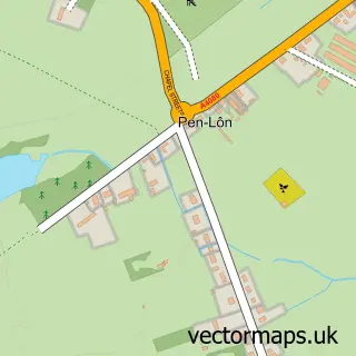
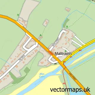
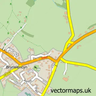
This Niwbwrch / Newborough street map is a detailed vector street map covering a 750m x 750m area. Select a larger area to create and download your own vector street map of Niwbwrch / Newborough.
The 750-metre map sample for Niwbwrch / Newborough covers 236 mapped buildings and approximately 10.2 km of road detail, of which 14 named roads are named. The immediate area includes 2 schools, 1 GP surgery within 2 miles, 1 pub and 1 MOT station within 2 miles. The wider area around Niwbwrch / Newborough features 2 tourism points of interest, 2 food and drink venues and 5 hotels. To create a larger or custom map of Niwbwrch / Newborough, the map builder lets you define your own coverage area and download editable SVG, PDF and PNG files.
Create a larger editable map of Niwbwrch / Newborough
Choose any area you need and generate a high-quality vector map instantly. Perfect for print, planning, design, business and personal use.

This Niwbwrch / Newborough street map in Gwynedd is available as downloadable SVG, PDF and PNG map files, or as a printed map for planning, business, display, education, local information and design work. You can also create a larger custom map area using the map selector.
What this Niwbwrch / Newborough map sample shows
Niwbwrch / Newborough lies within Rhosyr Community parish, part of Bro Aberffraw ward in the Sir Ynys Mon - Isle Of Anglesey local authority area. The postcode geography for this area includes the LL postcode area, the LL61 postcode district and the LL61 6 postcode sector. Residents fall under the Betsi Cadwaladr University Health Board for NHS services.
Local features near Niwbwrch / Newborough
Within 2 milesAmenities and services in and around Niwbwrch / Newborough.
Administrative and postcode information for Niwbwrch / Newborough
Niwbwrch / Newborough lies within Rhosyr Community parish, part of Bro Aberffraw ward in the Sir Ynys Mon - Isle Of Anglesey local authority area. The postcode geography for this area includes the LL postcode area, the LL61 postcode district and the LL61 6 postcode sector. Residents fall under the Betsi Cadwaladr University Health Board for NHS services.
Nearby street map samples around Niwbwrch / Newborough

More street maps in Gwynedd
750 metre map area coverage
Boundary, postcode and point of interest information for the 750m x 750m rectangle centred on this sample map.
Boundaries containing map centre
Constituency: Ynys Mon Co Const
District: Sir Ynys Mon - Isle of Anglesey
Icb: Betsi Cadwaladr University
Parish: Rhosyr Community
Police Force: north wales
Postcode District: LL61
Postcode Sector: LL61 6
Nearby boundaries intersecting sample
No additional intersecting boundaries found.
Postcode coverage
POI category counts
Hotel: 3
Elementary School: 2
Rv Park: 2
Campground: 1
Coffee Shop: 1
Community Center: 1
Construction Services: 1
Convenience Store: 1
Cottage: 1
Dog Park: 1
Sample points of interest
- Awelfryn Caravan Park
- Red Squirrel Tapas
- Eglwys Bach Community Hall
- RAG Construction & Groundworks
- Premier Premier Newborough
- Morannedd
- Pawen Lawen | Yap Land Dog Park
- Anglesey Electrical Contractors
- Niwbwrch Primary School
- Ysgol Santes Dwynwen
- The Codmother
- Sunnycliffe Holiday Cottages
Create a larger editable map of Niwbwrch / Newborough
This sample shows only a 750 metre area. To create a larger map of Niwbwrch / Newborough, use our map builder to choose your own coverage area, add titles and download editable SVG, PDF and PNG files.
Create a custom map of Niwbwrch / Newborough