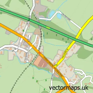
This Brynsiencyn street map is a detailed vector street map covering a 750m x 750m area. Select a larger area to create and download your own vector street map of Brynsiencyn.
The 750-metre map sample for Brynsiencyn covers 190 mapped buildings and approximately 10.7 km of road detail, of which 11 named roads are named. The immediate area includes 1 school and 1 pub. The wider area around Brynsiencyn features 2 tourism points of interest, 2 food and drink venues and 1 hotel. To create a larger or custom map of Brynsiencyn, the map builder lets you define your own coverage area and download editable SVG, PDF and PNG files.
Create a larger editable map of Brynsiencyn
Choose any area you need and generate a high-quality vector map instantly. Perfect for print, planning, design, business and personal use.

This Brynsiencyn street map in Gwynedd is available as downloadable SVG, PDF and PNG map files, or as a printed map for planning, business, display, education, local information and design work. You can also create a larger custom map area using the map selector.
What this Brynsiencyn map sample shows
Brynsiencyn lies within Llanidan Community parish, part of Bro Rhosyr ward in the Sir Ynys Mon - Isle Of Anglesey local authority area. The postcode geography for this area includes the LL postcode area, the LL61 postcode district and the LL61 6 postcode sector. Residents fall under the Betsi Cadwaladr University Health Board for NHS services.
Local features near Brynsiencyn
Within 2 milesAmenities and services in and around Brynsiencyn.
Administrative and postcode information for Brynsiencyn
The local authority covering Brynsiencyn is Sir Ynys Mon - Isle Of Anglesey, within the county of Gwynedd. The settlement lies within Bro Rhosyr ward and Llanidan Community civil parish. The LL61 postcode district and LL61 6 postcode sector serve the immediate area. NHS provision in the area is delivered through Betsi Cadwaladr University Health Board.
Nearby street map samples around Brynsiencyn

More street maps in Gwynedd
750 metre map area coverage
Boundary, postcode and point of interest information for the 750m x 750m rectangle centred on this sample map.
Boundaries containing map centre
Constituency: Ynys Mon Co Const
District: Sir Ynys Mon - Isle of Anglesey
Icb: Betsi Cadwaladr University
Parish: Llanidan Community
Police Force: north wales
Postcode District: LL61
Postcode Sector: LL61 6
Nearby boundaries intersecting sample
No additional intersecting boundaries found.
Postcode coverage
POI category counts
Cottage: 2
Atms: 1
Attractions And Activities: 1
Car Wash: 1
Coffee Shop: 1
Doner Kebab: 1
Elementary School: 1
Gutter Service: 1
Hotel: 1
Landmark And Historical Building: 1
Sample points of interest
- Bonlonder (EP53 Project)
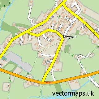
- Dwyran
- Clarity Cleaning
- Heritage Siop Coffi - Coffee Shop
- Menai Cottage
- Red Robin Cottage - Anglesey
- Brynsiencyn Kebab House
- Ysgol Brynsiencyn
- Go Gutter Cleaning
- Menai Holiday Cottages
- Brynsiencyn
- GEMs Laundry
Create a larger editable map of Brynsiencyn
This sample shows only a 750 metre area. To create a larger map of Brynsiencyn, use our map builder to choose your own coverage area, add titles and download editable SVG, PDF and PNG files.
Create a custom map of Brynsiencyn