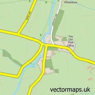
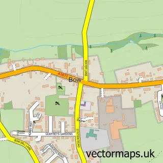
This North Tawton street map is a detailed vector street map covering a 750m x 750m area. Select a larger area to create and download your own vector street map of North Tawton.
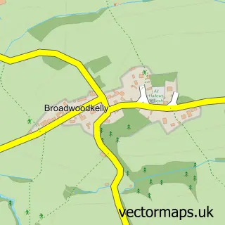
The 750-metre map sample for North Tawton covers 300 mapped buildings and approximately 10.0 km of road detail, of which 21 named roads are named. The immediate area includes 1 school, 4 pubs and 2 MOT stations within 2 miles. The wider area around North Tawton features 2 tourism points of interest and 5 food and drink venues. To create a larger or custom map of North Tawton, the map builder lets you define your own coverage area and download editable SVG, PDF and PNG files.
Create a larger editable map of North Tawton
Choose any area you need and generate a high-quality vector map instantly. Perfect for print, planning, design, business and personal use.

This North Tawton street map in Devon is available as downloadable SVG, PDF and PNG map files, or as a printed map for planning, business, display, education, local information and design work. You can also create a larger custom map area using the map selector.
What this North Tawton map sample shows
North Tawton lies within North Tawton Cp parish, part of Exbourne ward in the West Devon District (B) local authority area. The postcode geography for this area includes the EX postcode area, the EX20 postcode district and the EX20 2 postcode sector. Residents fall under the Nhs Devon Integrated Care Board for NHS services.
Local features near North Tawton
Within 2 milesAmenities and services in and around North Tawton.
Administrative and postcode information for North Tawton
North Tawton lies within North Tawton Cp parish, part of Exbourne ward in the West Devon District (B) local authority area. The postcode geography for this area includes the EX postcode area, the EX20 postcode district and the EX20 2 postcode sector. Residents fall under the Nhs Devon Integrated Care Board for NHS services.
Nearby street map samples around North Tawton

More street maps in Devon
750 metre map area coverage
Boundary, postcode and point of interest information for the 750m x 750m rectangle centred on this sample map.
Boundaries containing map centre
Constituency: Central Devon Co Const
County: Devon County
District: West Devon District (B)
Icb: NHS Devon ICB
Parish: North Tawton CP
Police Force: devon and cornwall
Postcode District: EX20
Postcode Sector: EX20 2
Ward: Exbourne Ward
Nearby boundaries intersecting sample
No additional intersecting boundaries found.
Postcode coverage
POI category counts
Pub: 4
Professional Services: 3
Clothing Store: 2
Convenience Store: 2
Dentist: 2
Elementary School: 2
Farm: 2
Fish And Chips Restaurant: 2
Pharmacy: 2
Advertising Agency: 1
Sample points of interest
- Rob Harris Productions
- Clifford Dennis Agricultural Services
- Ruth Smith Gallery
- North Street Motors
- Natwest
- Roots Barbers
- Angels
- Amber Parnell Colour Specialist
- C H Jones And Son
- A L Martin & Son
- St Peter's Church
- Jules Porter Originals
Create a larger editable map of North Tawton
This sample shows only a 750 metre area. To create a larger map of North Tawton, use our map builder to choose your own coverage area, add titles and download editable SVG, PDF and PNG files.
Create a custom map of North Tawton