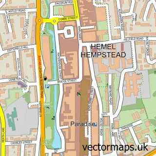
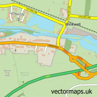
This Old Town street map is a detailed vector street map covering a 750m x 750m area. Select a larger area to create and download your own vector street map of Old Town.
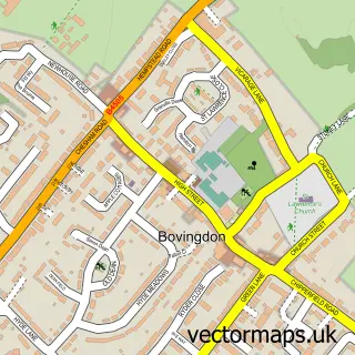
The 750-metre map sample for Old Town covers 312 mapped buildings and approximately 18.8 km of road detail, of which 47 named roads are named. The immediate area includes 1 school, 6 GP surgeries within 2 miles, 5 pubs and 23 MOT stations within 2 miles. The wider area around Old Town features 5 tourism points of interest and 15 food and drink venues. To create a larger or custom map of Old Town, the map builder lets you define your own coverage area and download editable SVG, PDF and PNG files.
Create a larger editable map of Old Town
Choose any area you need and generate a high-quality vector map instantly. Perfect for print, planning, design, business and personal use.

This Old Town street map in Hertfordshire is available as downloadable SVG, PDF and PNG map files, or as a printed map for planning, business, display, education, local information and design work. You can also create a larger custom map area using the map selector.
What this Old Town map sample shows
Old Town lies within Hertfordshire County parish, part of Apsley And Corner Hall ward in the Dacorum District (B) local authority area. The postcode geography for this area includes the HP postcode area, the HP3 postcode district and the HP3 9 postcode sector. Residents fall under the Nhs Hertfordshire And West Essex Integrated Care Board for NHS services.
Local features near Old Town
Within 2 milesAmenities and services in and around Old Town.
Administrative and postcode information for Old Town
The local authority covering Old Town is Dacorum District (B), within the county of Hertfordshire. The settlement lies within Apsley And Corner Hall ward and Hertfordshire County civil parish. The HP3 postcode district and HP3 9 postcode sector serve the immediate area. NHS provision in the area is delivered through West Hertfordshire Teaching Hospitals Nhs Trust.
Nearby street map samples around Old Town

More street maps in Hertfordshire
750 metre map area coverage
Boundary, postcode and point of interest information for the 750m x 750m rectangle centred on this sample map.
Boundaries containing map centre
Constituency: Hemel Hempstead Co Const
County: Hertfordshire County
District: Dacorum District (B)
Icb: NHS Central East ICB
Police Force: hertfordshire
Postcode District: HP1
Postcode Sector: HP1 3
Ward: Hemel Hempstead Town Ward
Nearby boundaries intersecting sample
Postcode District: HP2
Postcode Sector: HP1 1, HP2 4, HP2 5
Ward: Boxmoor Ward, Gadebridge Ward, Highfield Ward
Postcode coverage
POI category counts
Real Estate Agent: 20
Hair Salon: 11
Beauty Salon: 10
Advertising Agency: 7
Charity Organization: 6
Indian Restaurant: 6
Restaurant: 6
Fast Food Restaurant: 5
Professional Services: 5
Pub: 5
Sample points of interest
- My Accountant Friend
- Neils Limited
- Tax2Fix
- Herb Zhao
- A D / O P T
- Elsie B
- Full on Marketing
- My Mustard
- R T Facts
- Rtfacts Ltd.
- Silver Chair Marketing
- Gemma Bailey
Create a larger editable map of Old Town
This sample shows only a 750 metre area. To create a larger map of Old Town, use our map builder to choose your own coverage area, add titles and download editable SVG, PDF and PNG files.
Create a custom map of Old Town