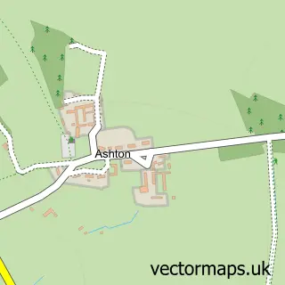
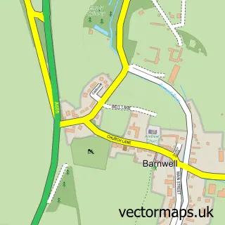
This Oundle street map is a detailed vector street map covering a 750m x 750m area. Select a larger area to create and download your own vector street map of Oundle.
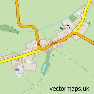
The 750-metre map sample for Oundle covers 351 mapped buildings and approximately 13.2 km of road detail, of which 36 named roads are named. The immediate area includes 2 schools, 1 GP surgery within 2 miles and 2 pubs. The wider area around Oundle features 1 tourism point of interest, 10 food and drink venues and 2 hotels. To create a larger or custom map of Oundle, the map builder lets you define your own coverage area and download editable SVG, PDF and PNG files.
Create a larger editable map of Oundle
Choose any area you need and generate a high-quality vector map instantly. Perfect for print, planning, design, business and personal use.

This Oundle street map in Northamptonshire is available as downloadable SVG, PDF and PNG map files, or as a printed map for planning, business, display, education, local information and design work. You can also create a larger custom map area using the map selector.
What this Oundle map sample shows
Oundle lies within Oundle Cp parish, part of Oundle ward in the North Northamptonshire local authority area. The postcode geography for this area includes the PE postcode area, the PE8 postcode district and the PE8 4 postcode sector. Residents fall under the Nhs Northamptonshire Integrated Care Board for NHS services.
Local features near Oundle
Within 2 milesAmenities and services in and around Oundle.
Administrative and postcode information for Oundle
Oundle lies within Oundle Cp parish, part of Oundle ward in the North Northamptonshire local authority area. The postcode geography for this area includes the PE postcode area, the PE8 postcode district and the PE8 4 postcode sector. Residents fall under the Nhs Northamptonshire Integrated Care Board for NHS services.
Nearby street map samples around Oundle

More street maps in Northamptonshire
750 metre map area coverage
Boundary, postcode and point of interest information for the 750m x 750m rectangle centred on this sample map.
Boundaries containing map centre
Constituency: Corby and East Northamptonshire Co Const
District: North Northamptonshire
Icb: NHS Northamptonshire ICB
Parish: Oundle CP
Police Force: northamptonshire
Postcode District: PE8
Postcode Sector: PE8 4
Ward: Oundle Ward
Nearby boundaries intersecting sample
Parish: Barnwell CP
Postcode Sector: PE8 5
Ward: Thrapston Ward
Postcode coverage
POI category counts
Beauty Salon: 6
Flowers And Gifts Shop: 6
Barber: 5
Hair Salon: 5
Beauty And Spa: 4
Charity Organization: 4
Farmers Market: 4
Art Gallery: 3
Church Cathedral: 3
Coffee Shop: 3
Sample points of interest
- Bulley Davey
- Crafty Things
- Power Marketing UK
- Jonathan Simmonds Osteopath
- Oundle Osteopaths
- St Peter's Church
- Oundle Veterinary Surgery
- Oundle Veterinary Surgery
- Green Man Antiques
- Oundle Air Ambulance Service
- Paul Bancroft Architects
- Fine Art
Create a larger editable map of Oundle
This sample shows only a 750 metre area. To create a larger map of Oundle, use our map builder to choose your own coverage area, add titles and download editable SVG, PDF and PNG files.
Create a custom map of Oundle